My Scottish Lighthouse Project is an extended photography project with the aim of visiting every mainland lighthouse in Scotland. Starting in my local area of Dumfries & Galloway I am working my way up the west coast of Scotland. Here you will find full resolution images from my trips.
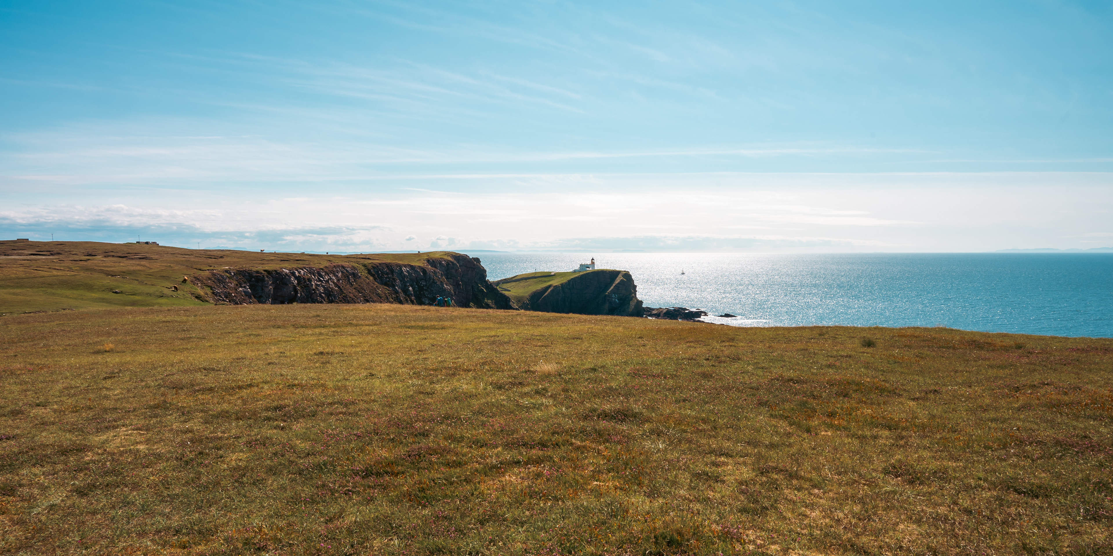
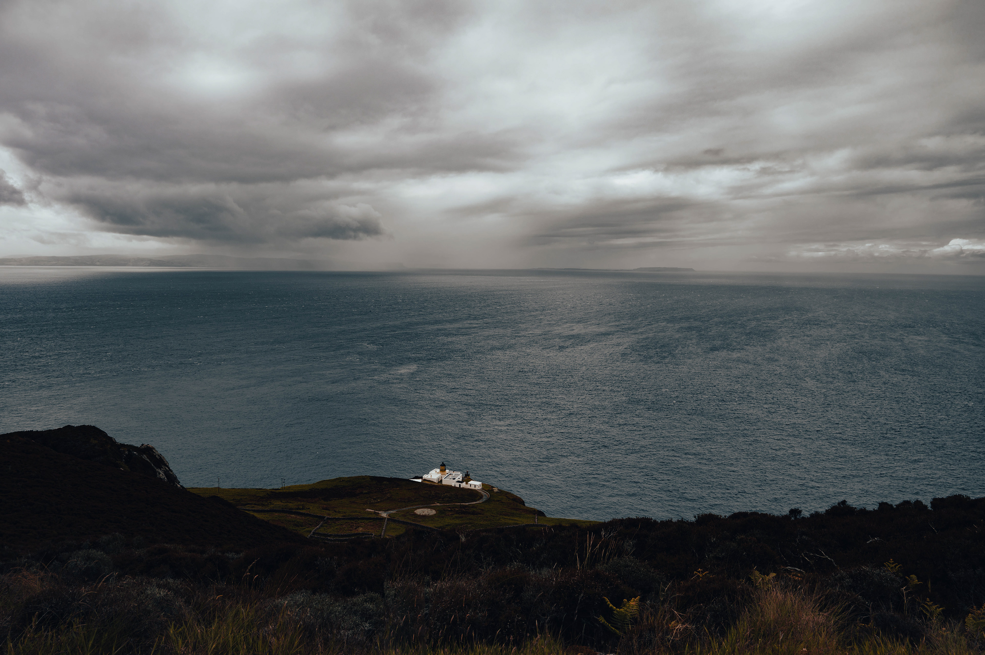
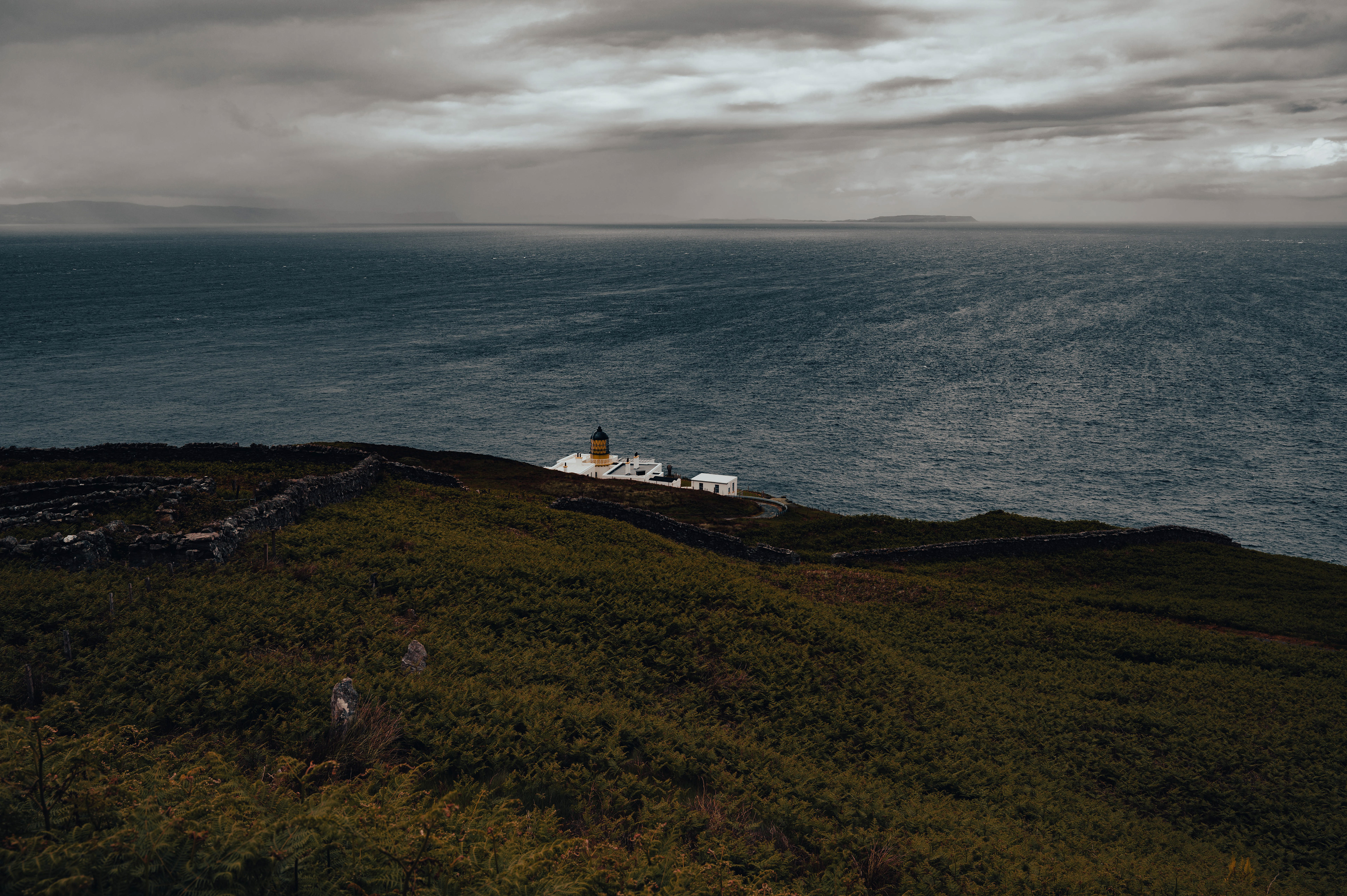
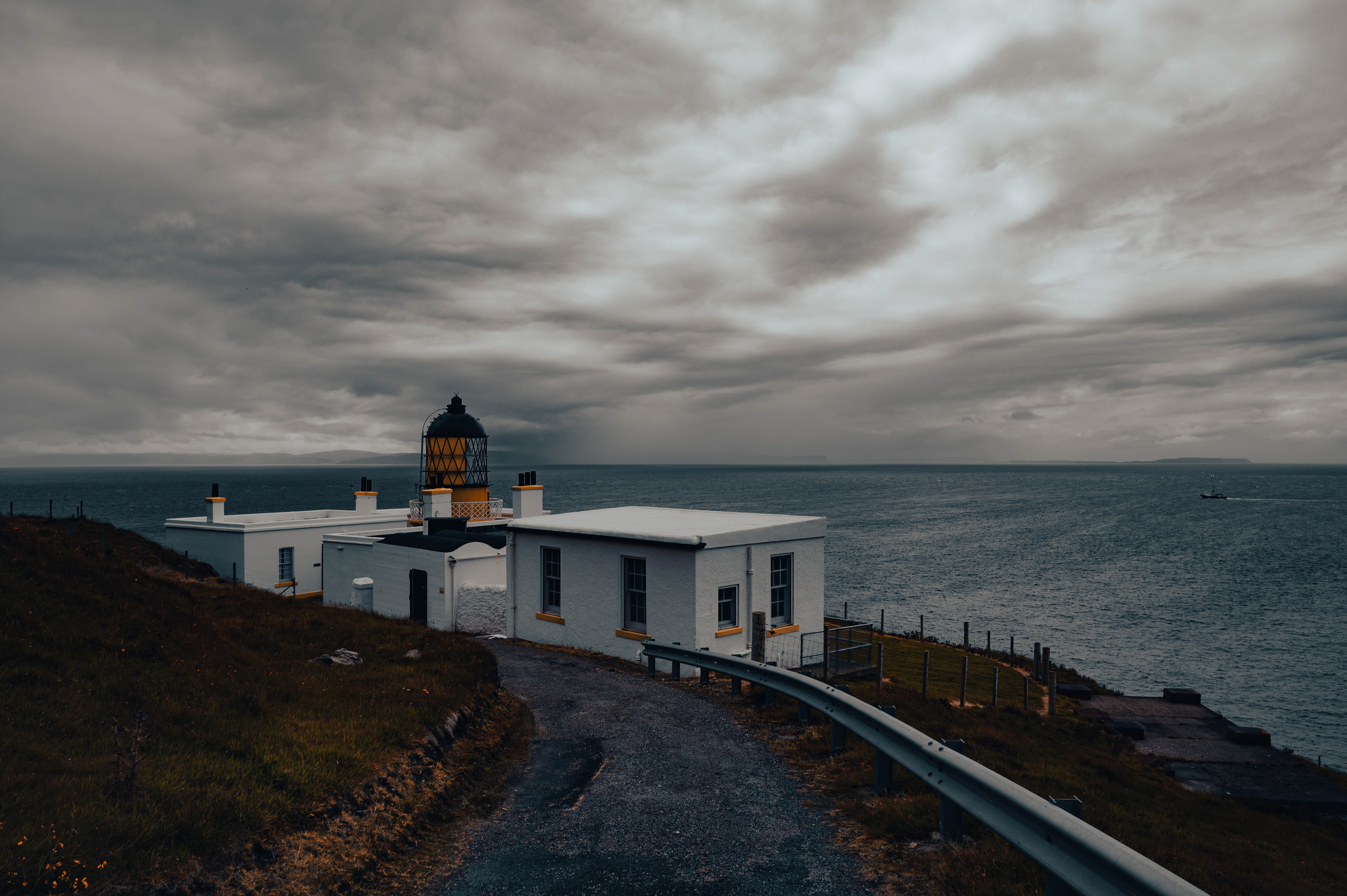
STOER HEAD LIGHTHOUSE
58°14′24″N 5°24′9″W
With views across the Minch to the Outer Hebrides, Skye as well as up the West Coast to Cape Wrath and in-land to Suilven. The Lighthouse was designed and built by the brothers, David andThomas Stevenson in 1870 on Stoer Head one of 45 sites around Scotland where it was deemed necessary to build a lighthouse in order to protect shipping around the coast. In order to bring building materials and supplies to the remote point a jetty was constructed a mile and half down the coast as there were no access roads at the time. The jetty could not be built any closer to the site due to the cliffs that the lighthouse sits on making a landing site impossible. The height of these cliffs meant that the tower did not need to be particularly tall only 14 meters, whilst still giving a light range of 24 miles out to sea.
The light was maned until automation in 1978. The families of the lighthouse keepers had to be fairly self sufficient and the remains of their store houses and cattle sheds can still be seen today. Their children were schooled in the local primary but many had to go to boarding schools for their secondary education as there were no secondary schools close enough to the lighthouse. The keepers cottages are now holiday accommodation.

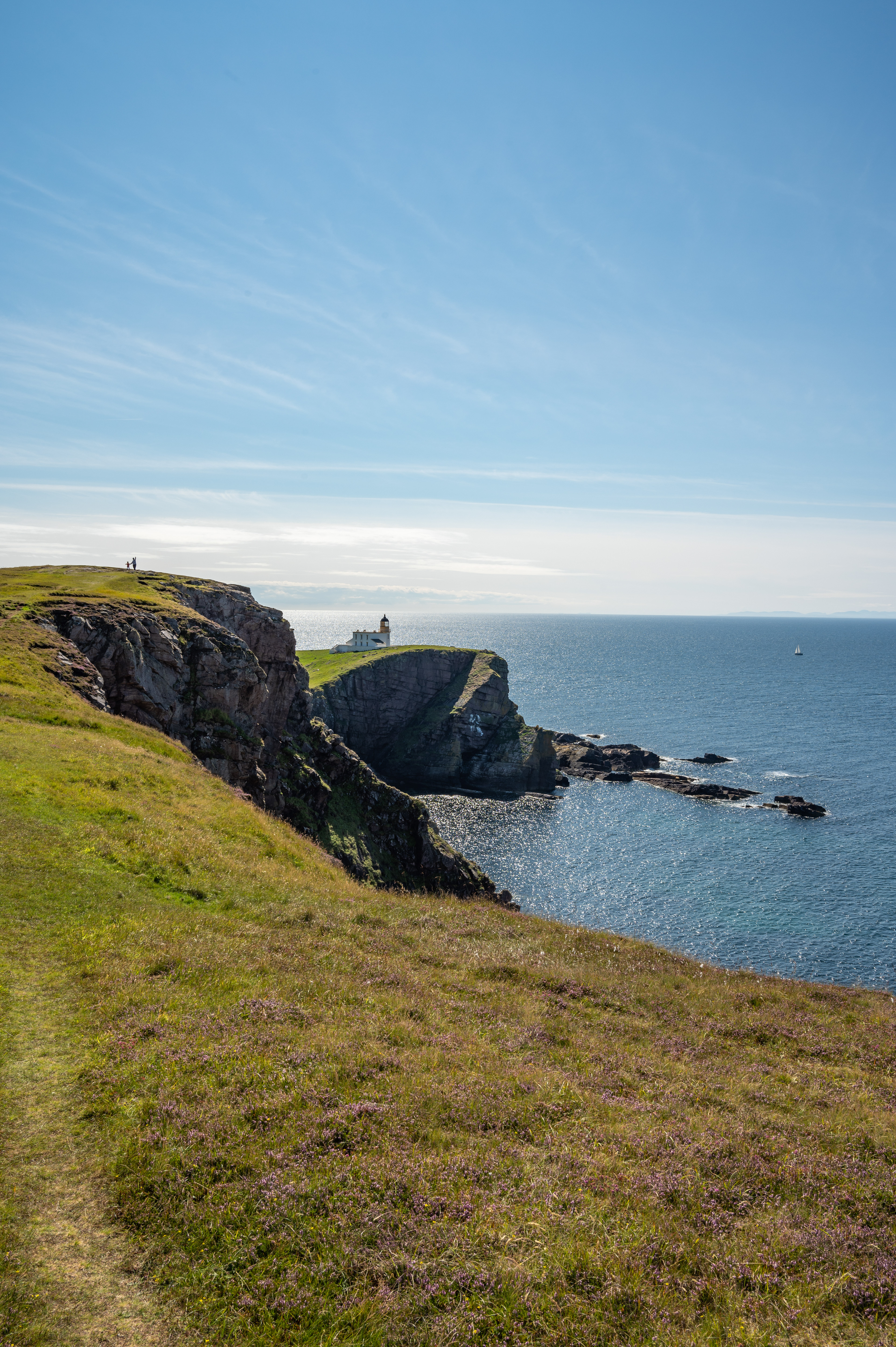

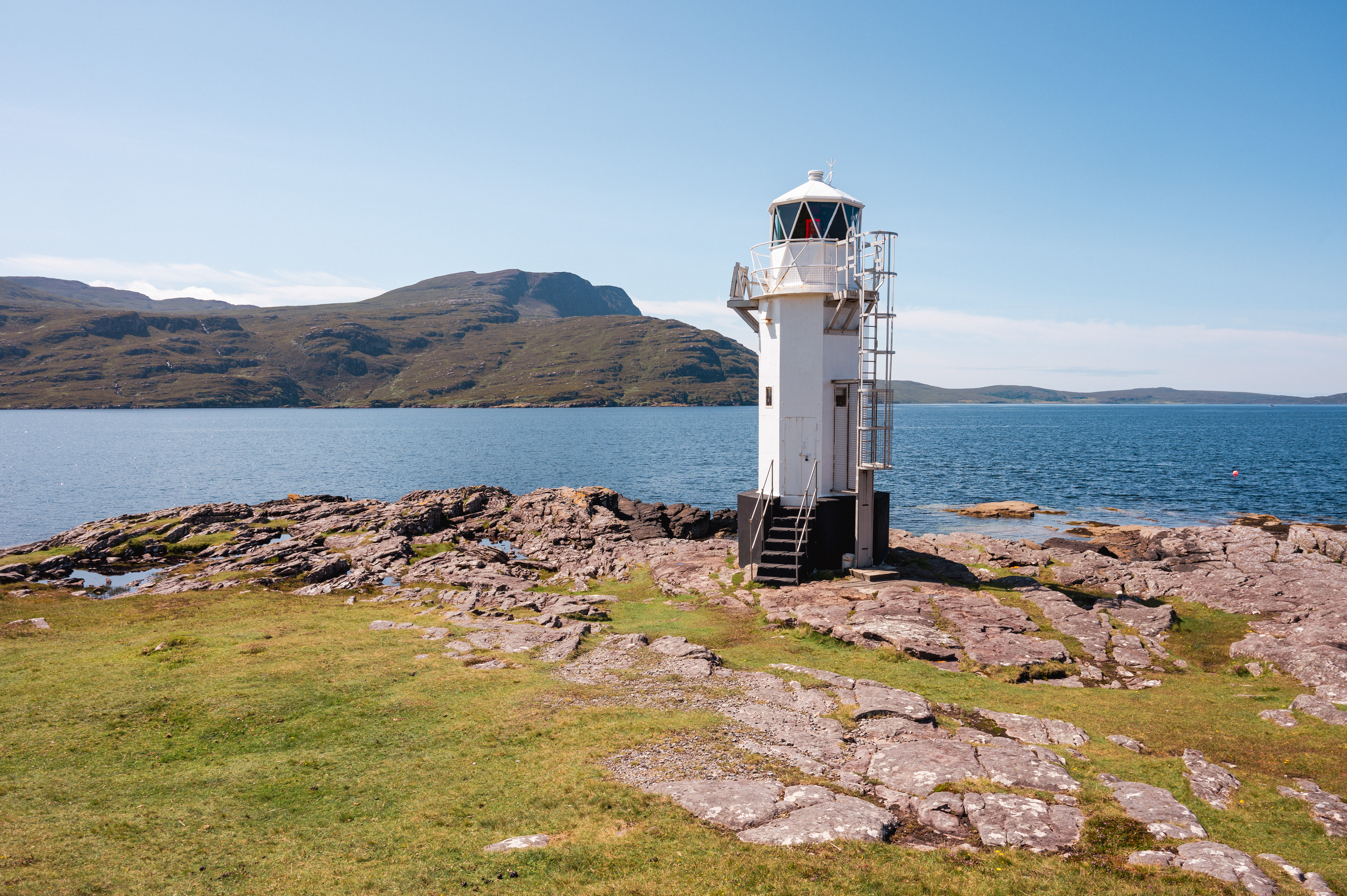
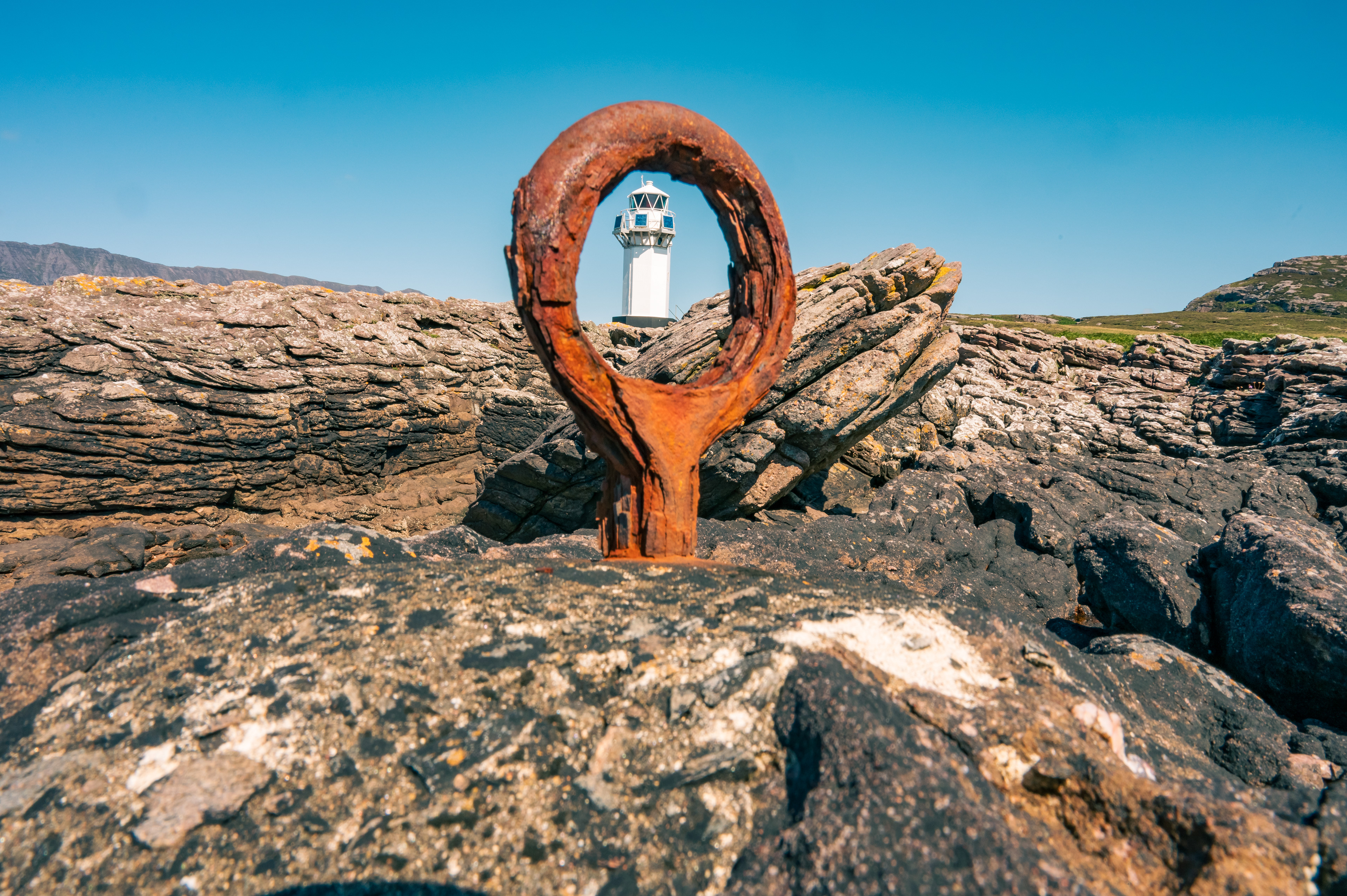
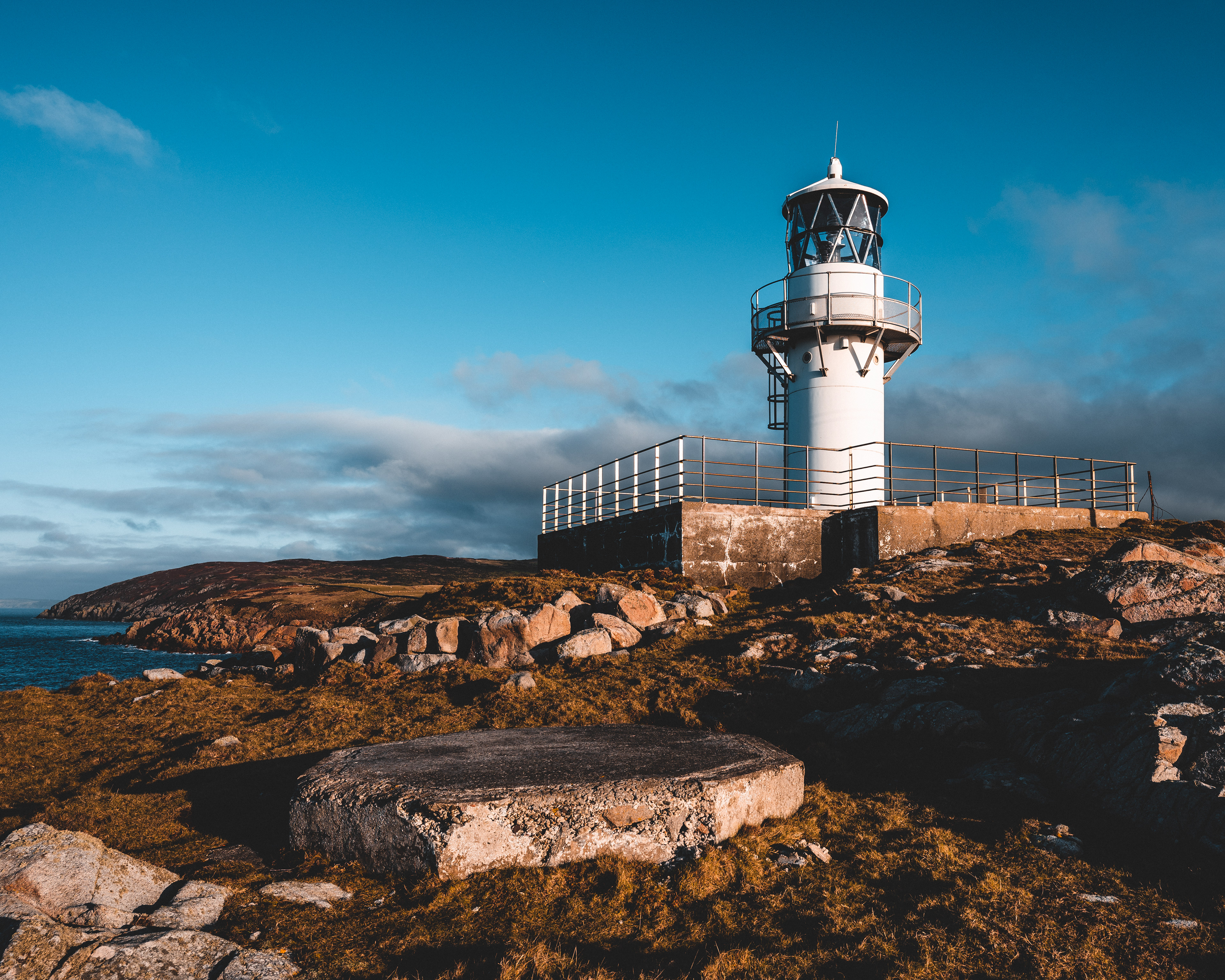
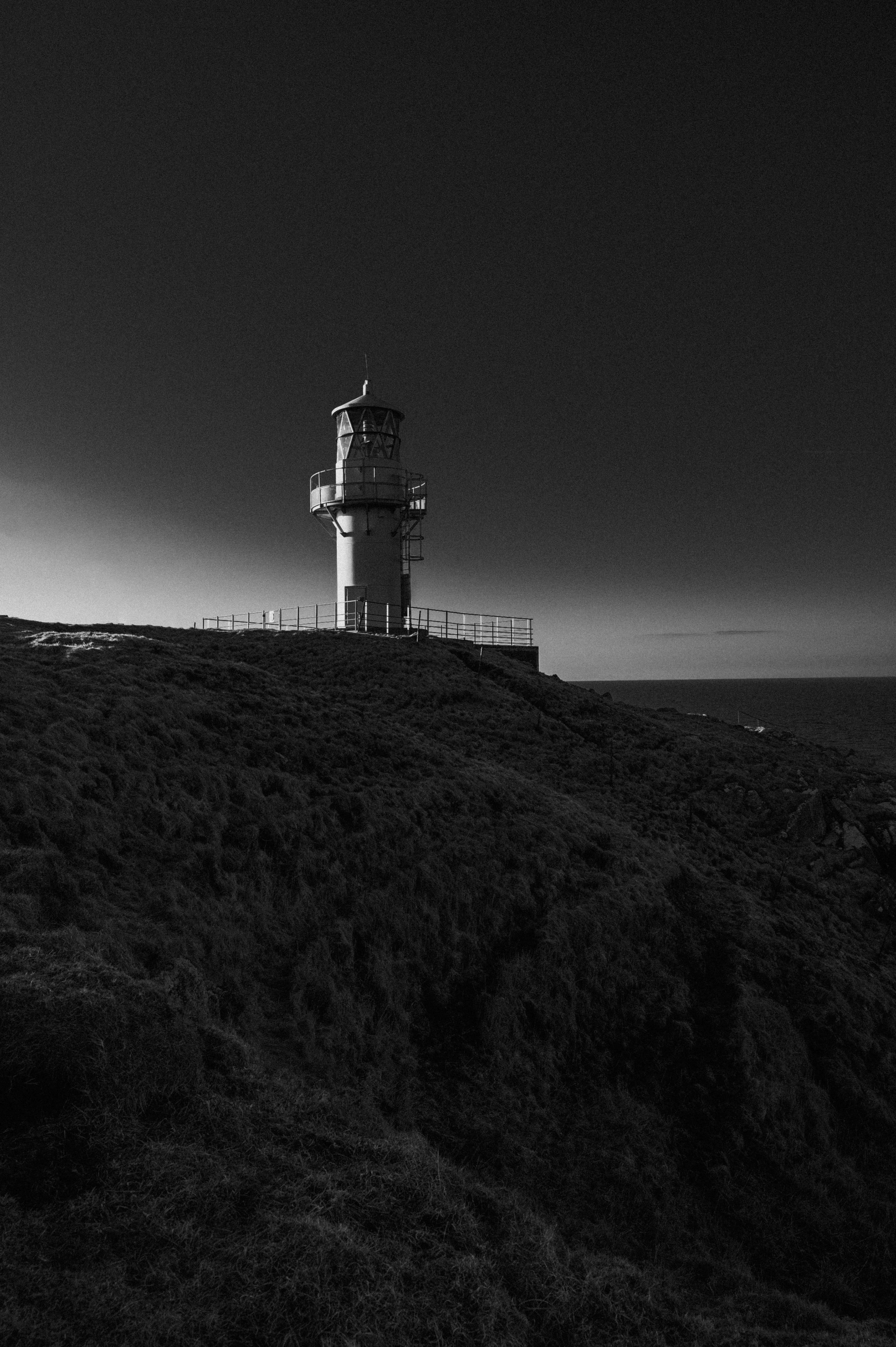
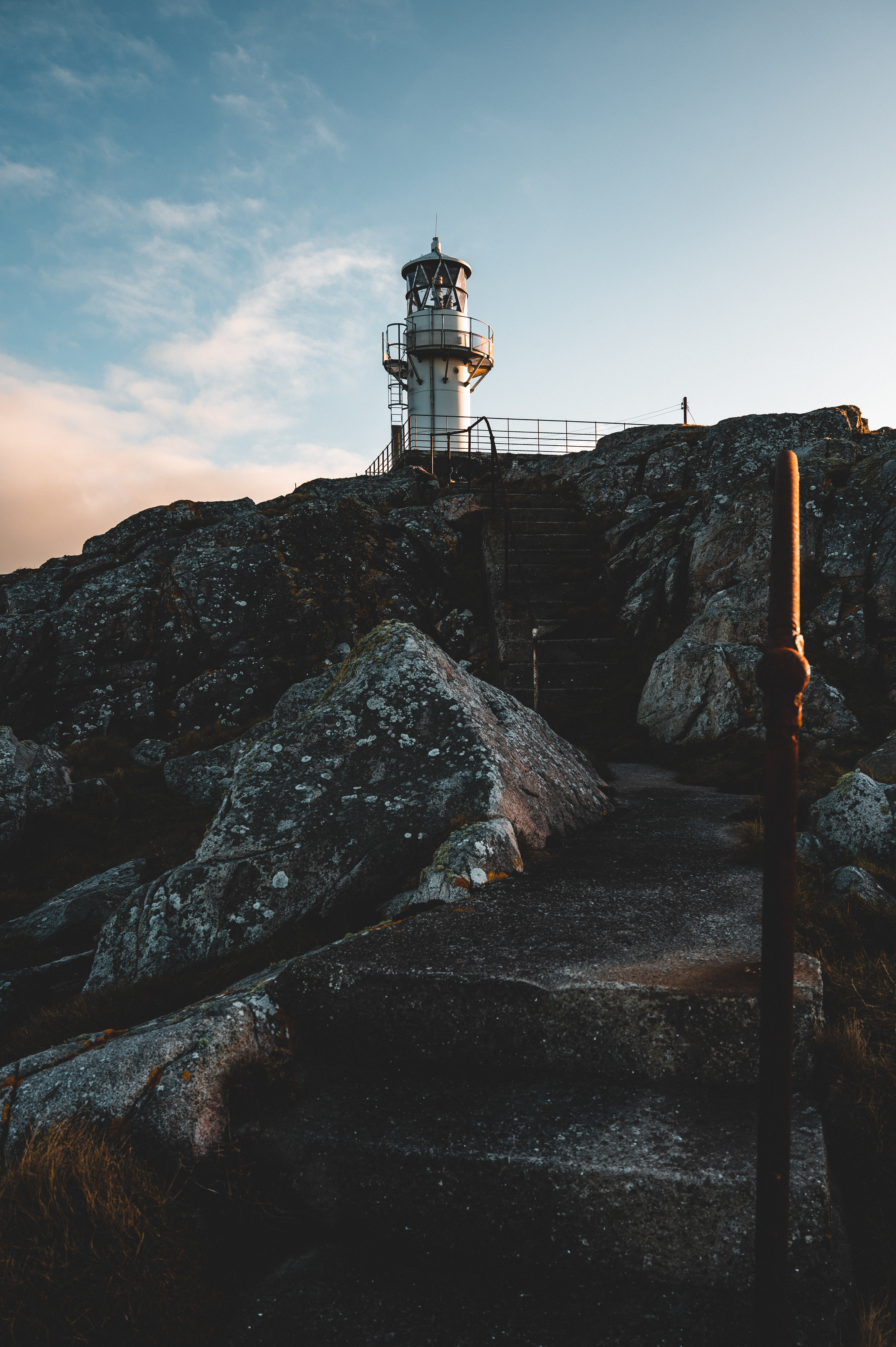
RHUE LIGHTHOUSE
57º55'30"N 5º13'23"W
This small modern lighthouse guards the entrance to Loch Broom. Guiding ships into the harbour at Ullapool. Siting on a small headland the light boasts amazing views over the Summer Isles, and the wall of Ben More Coigach to the North.
The name of both the lighthouse and nearby hamlet, Rhue, comes from the Gàidhlig, An Rubha, meaning headland. The full name of the area is "Rubhacadail" meaning, "Headland of the sleepy people." From an old legend about a group of shipwrecked sailors, found washed up asleep but completely unharmed on the rocks where the lighthouse now stands. On early maps the hamlet was called, Ard-a-chadail, or Village of the Sleepy People.

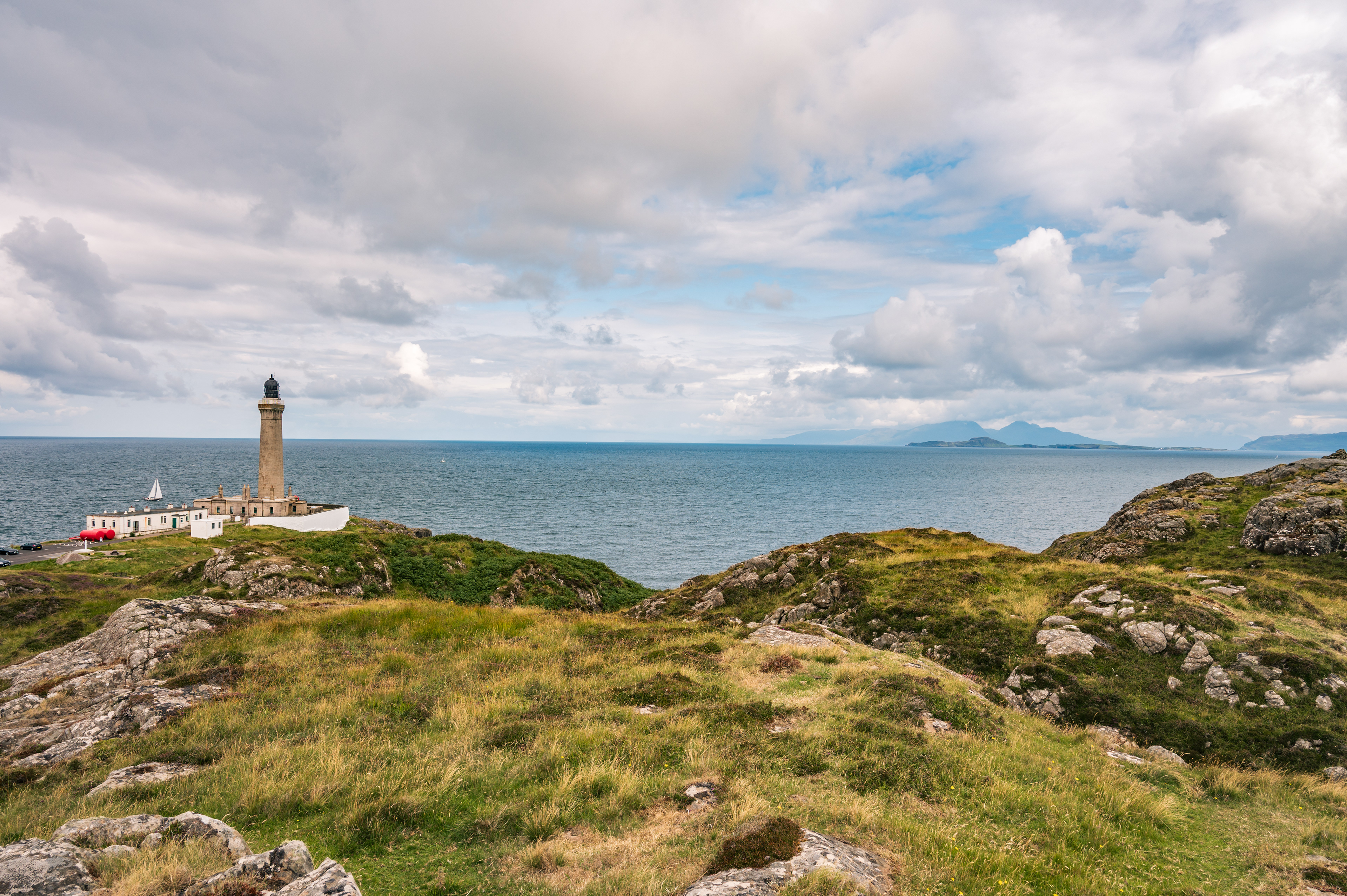
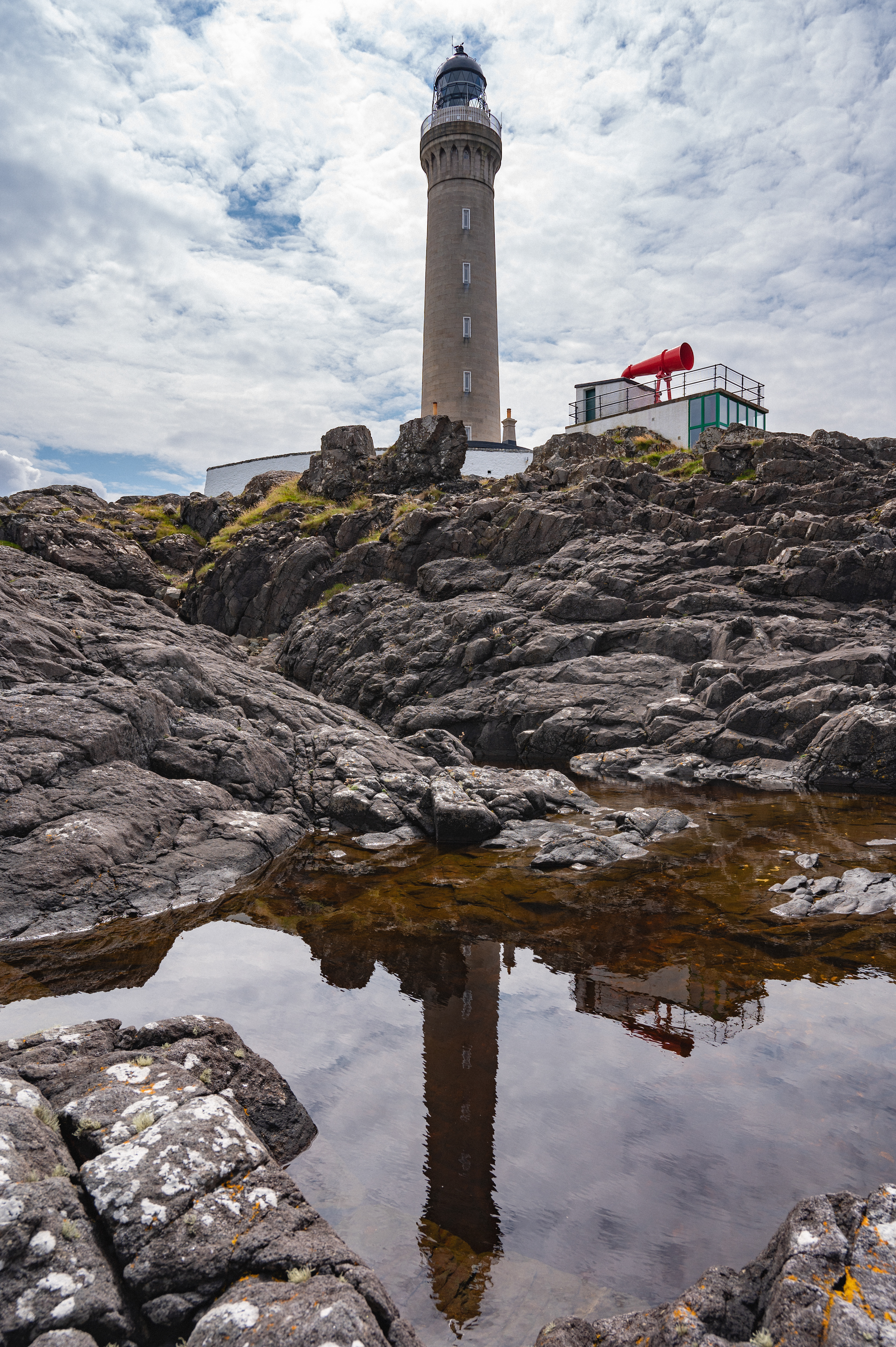
ARDNAMURCHAN LIGHTHOUSE
56°43′37″N 6°13′34″W
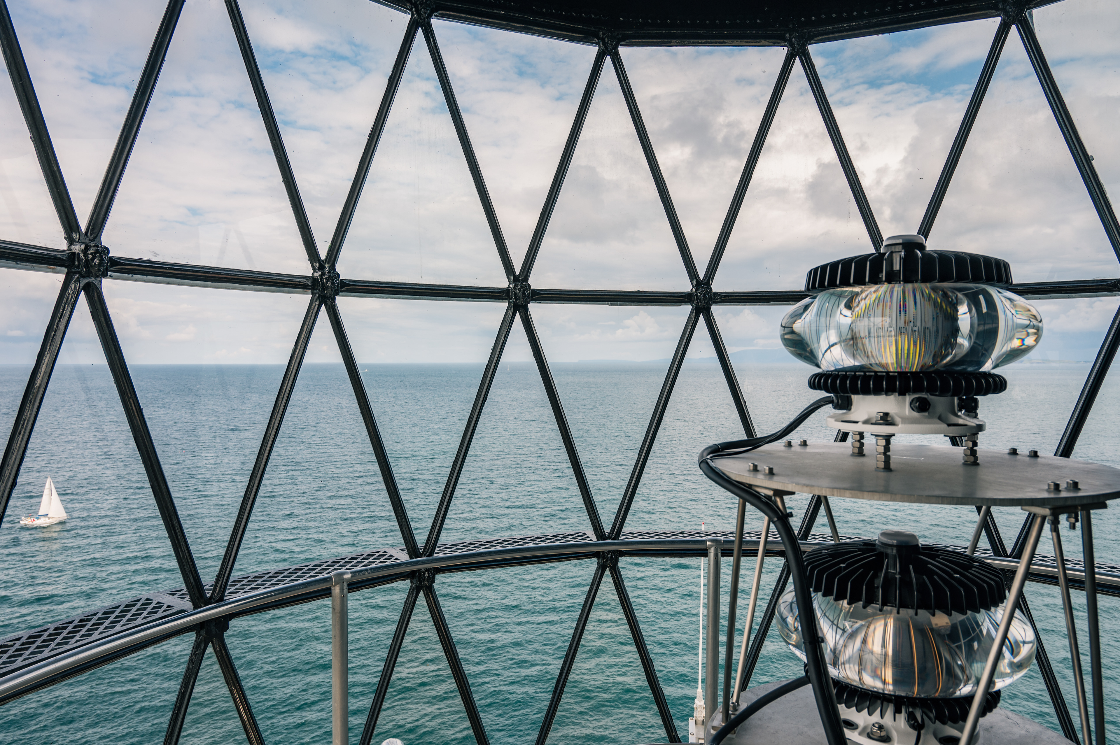
Ardnamurchan Lighthouse sits on the most Westerly point in Mainland Britain, Ardnamurchan Point or Rubha Àird nam Murchan in Gàidhlig. The tower offers views over the islands of Mull, Coll, Rùm, Eigg, Muck, and on a clear day the Isle of Skye and even glimpses of the Outer Hebrabies. To say nothing of the views inland back up the Ardnamurchan peninsula.
The lighthouse tower and keepers’ cottages were designed in the “Egyptian Style” by Alan Stevenson Uncle to the Author, Robert Louis Stevenson. It is the only Lighthouse in Britain built in this style. The Styling is most obvious around the entrance to the tower, the decorative arches beneath the balcony and the chimneys of the cottages. The lamp room at the top of the tower also is decorated with bronze lion heads between each window, today they are painted to better preserve them. The Light house was built of pink granite quarried on the Isle of Mull. The tower is 36 meters tall and has an effective range of 24 nautical miles. The Lighthouse was completed in 1849. Two keepers lived on site full time with their families.
They would spend one week on nightshift and then one week on day shift, except in the heart of winter when darkness lasts for 14 hours. Then, each keeper would complete a seven hour shift each night. The on shift keeper was expected to be in full uniform for their full shift even if they were alone tending the light in the middle of the night. The keepers nightly duties were not just limited to keeping the light burning. One of their main tasks was to wind the clockwork that drove the slotted drum that gave the light its unique pattern of flashes. This unique pattern allowed sailors to identify exactly which lighthouse they were seeing and was Vitaly important. The clockwork was installed down the middle of the tower and had a large heavy weight attached to a chain. As the weight dropped it drove the mechanism that rotated the drum around the lamp. When the weight reached the bottom of the tower it would take the keeper almost 30 minutes to wind it back to the top of the tower. The clockwork wound down every hour and a half. Before the installation of the foghorn, another of the keepers tasks in foggy weather would be to stand at the top of the tower throughout their shift and fire a shotgun at regular intervals to warn ships off the rocks.
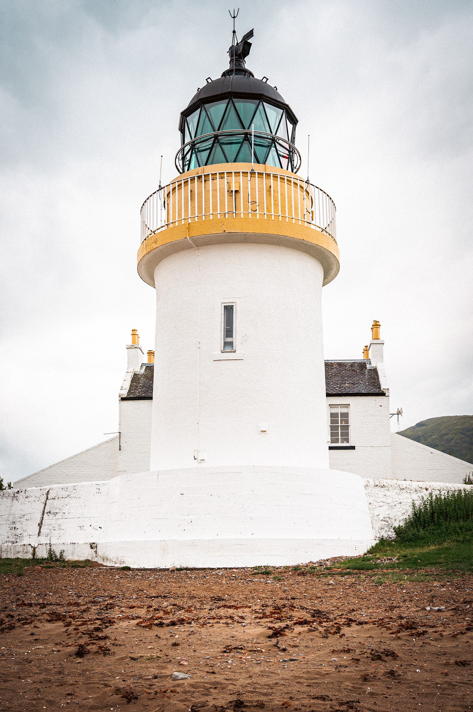
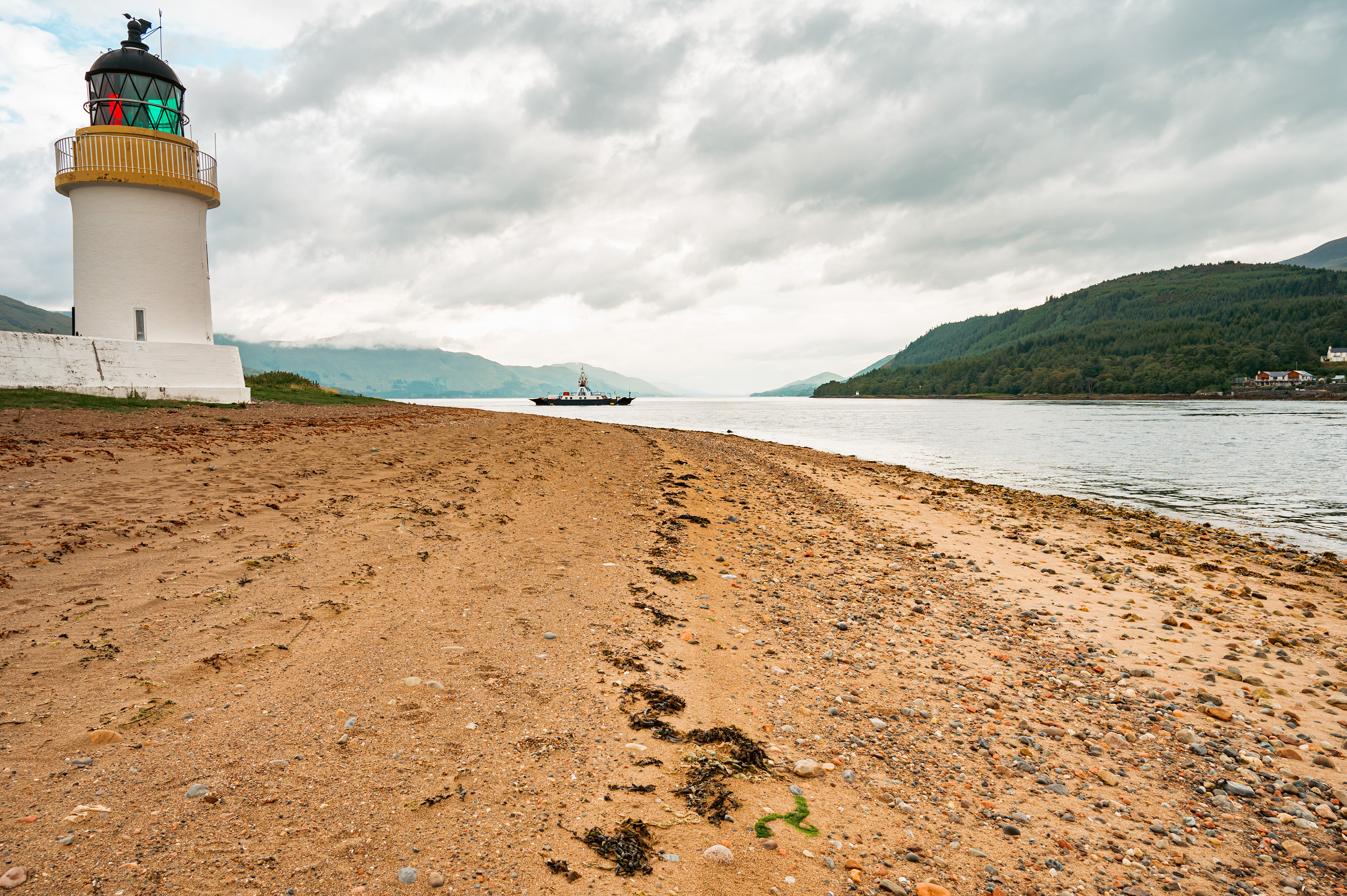
CORRAN POINT LIGHTHOUSE
56°43'15"N 5°14'32”W
Built by David and Thomas Stevenson for the Northern Lighthouse Board in 1860. Corran Point Lighthouse was built to assist navigation through the Narrows on Loch Linnhe. The Narrows are the crossing point of the Corran Ferry south of Fort William. The ferry transports passengers and goods to and from the Ardnamurchan peninsula and is a vital lifeline for the communities there. Cutting travel time to Fort William the nearest major town by up to an hour.
The light uses a constant white beam up and down the loch visible from up to ten miles away. With red and green coloured lights shining across the narrows. The light was the first to be made automatic in 1898.

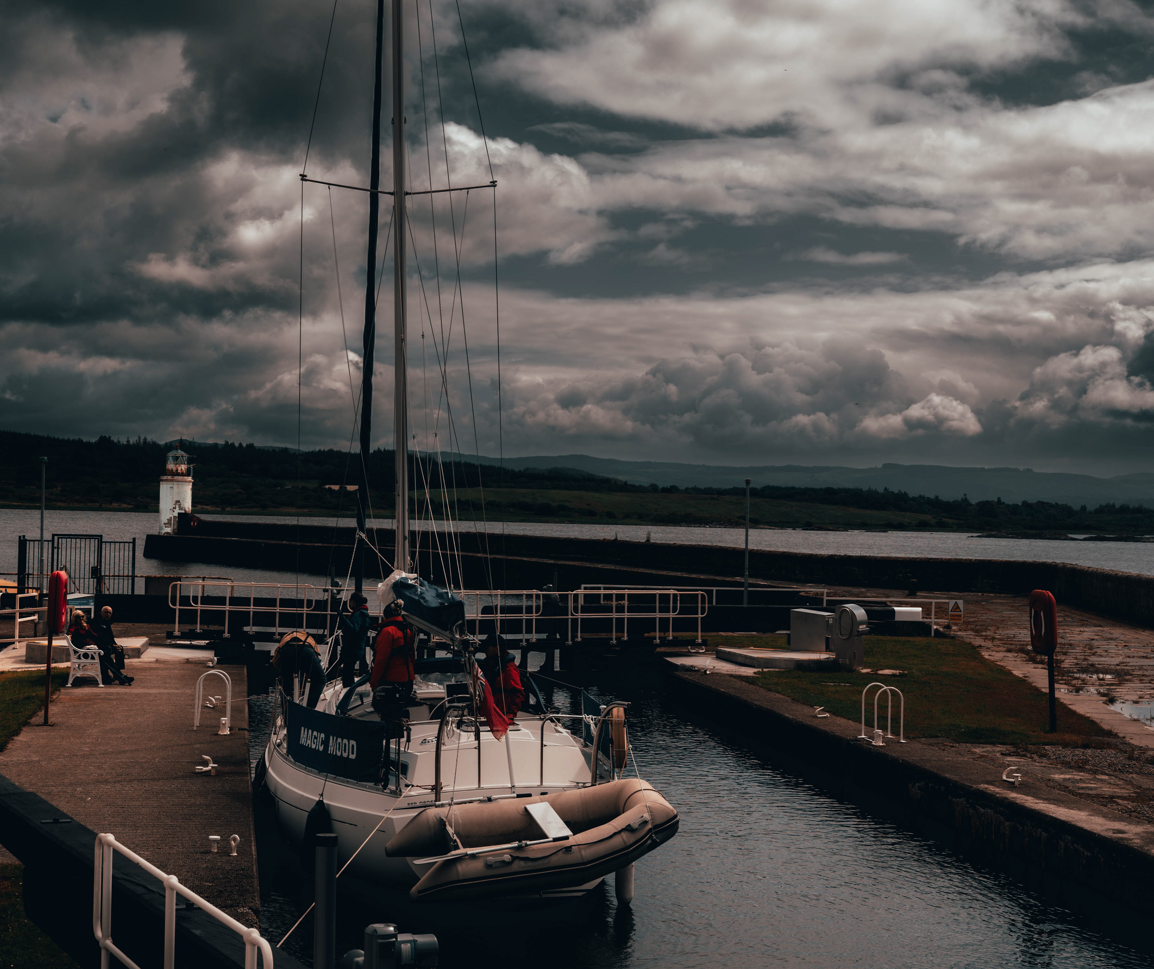
CALEDONIAN CANAL "PEPPER-POT" LIGHTHOUSES
The Caledonian Canal stretches between Inverness, and Fort William. Linking Loch Dochfour, Loch Ness, Loch Oich, and Loch Lochy down the length of the Great Glen. The Canal was constructed in the early 1800s and finished in 1822. Initially scheduled to take 7 years the construction ended up taking 19 years and came in £560,000 over budget or roughly £58,500,000 in modern money. The canal has 29 locks and a depth of 15ft. Allowing all but the largest boats to pass through the canal. This spared many ships from the much longer and more dangerous route around Cape Wrath, and John o’ Groats. At points where the canal opens into the various lochs along its route small lighthouses were constructed to guide ships safely into the the next section of the canal.
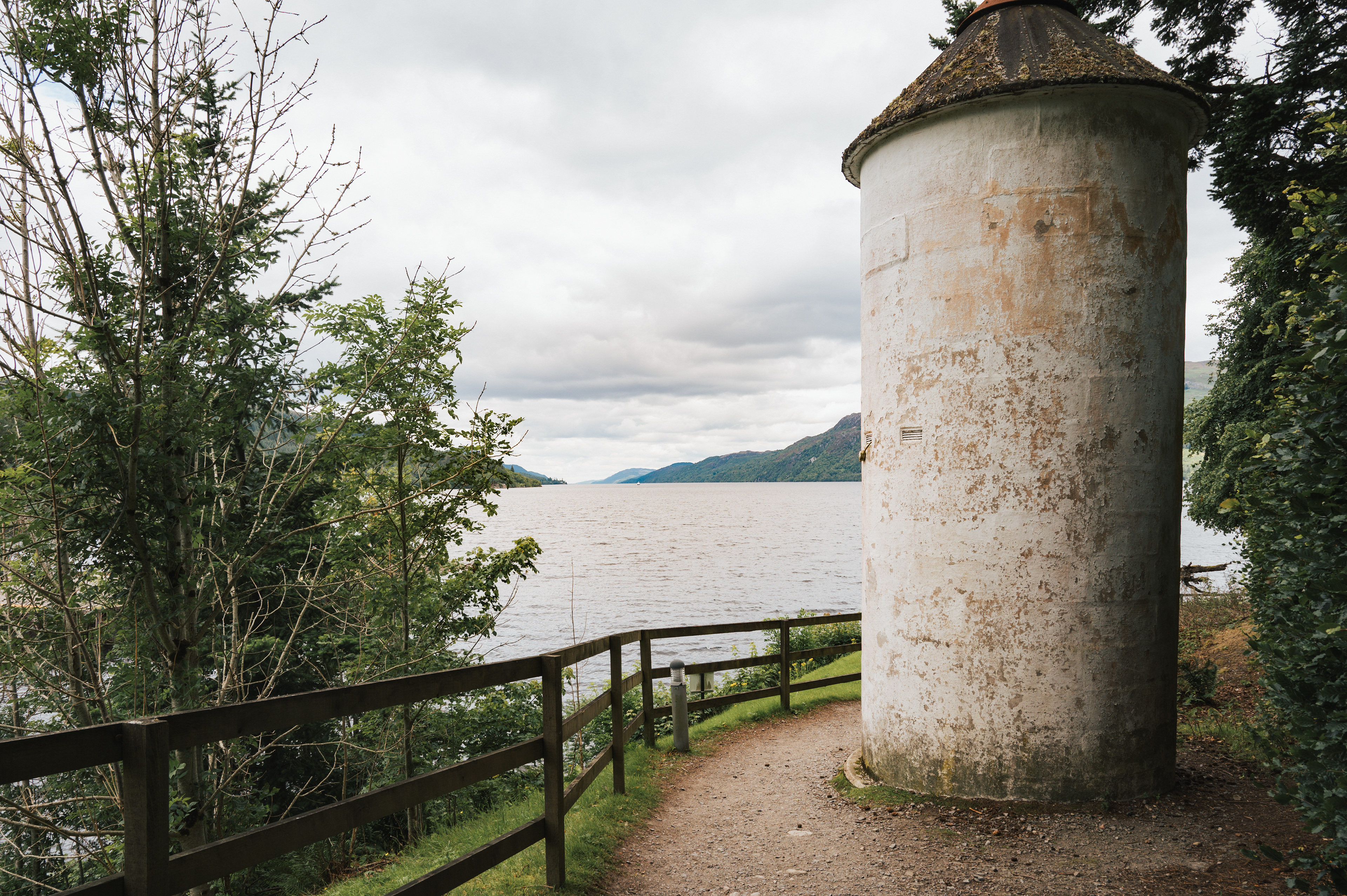
FORT AUGUSTS
57º8'45"N 4º40'30"W
One of these small lighthouses guiding boats off of Loch Ness and into the five lock staircase that rises through the village of Fort Augustus. Fort Augustus was originally called Kiliwhimin, but after General Wade built a fort in 1742, named after the Duke of Cumberland, Prince William Augustus, the name of the fort was adopted for the whole village in English. In Modern Gàidhlig the name of the village is, Cille Chuimein.
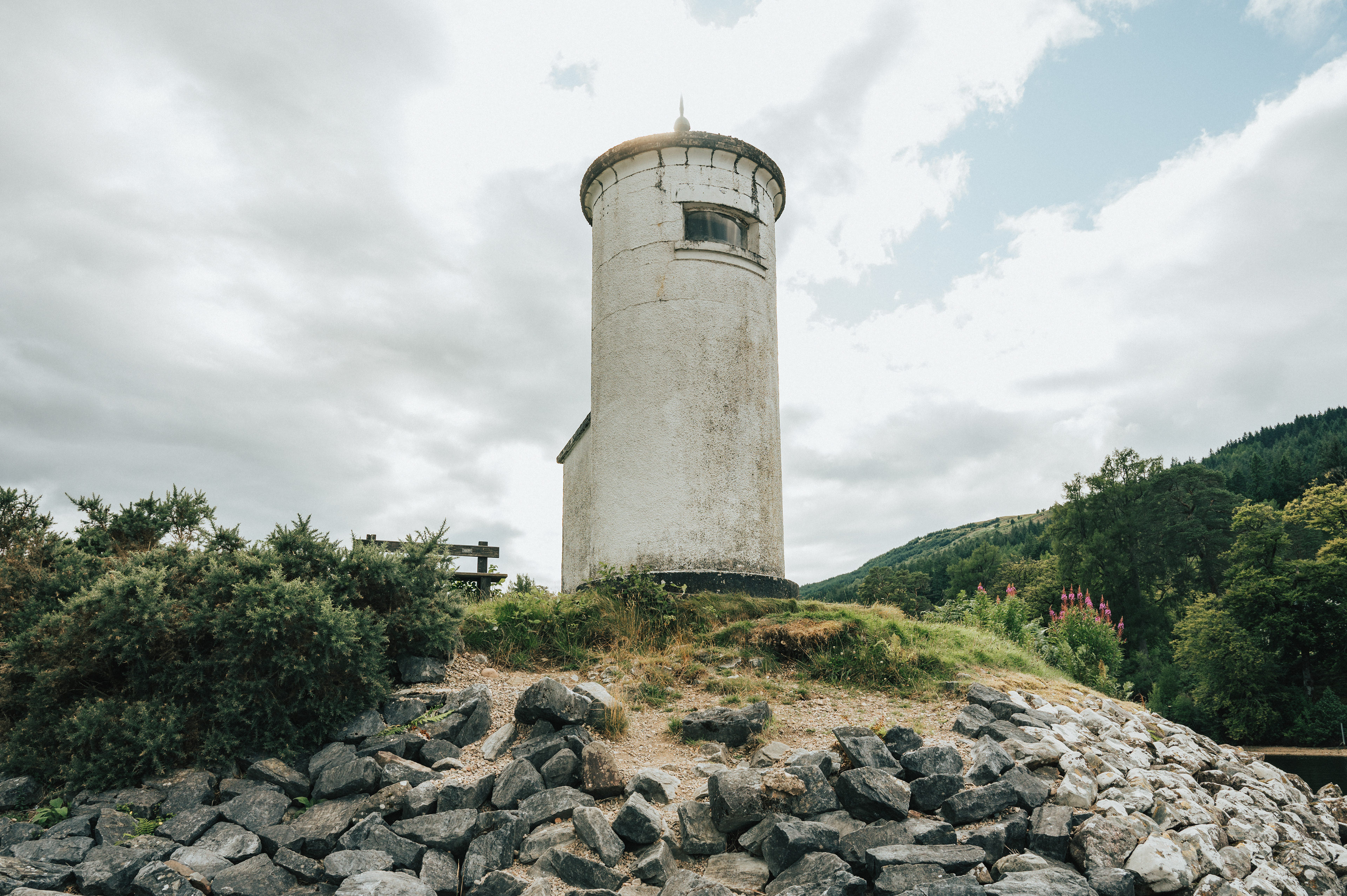
LOCH LOCHY
56º55’1’N 5º7’26”W
This small Lighthouse stands on the south shore of Loch Lochy, Loch Lòchaidh in Gàidhlig, near the small settlement of Gairlochy. One of the earliest recorded names for the loch comes from “The Life of Saint Columbus” and translates as the Black Goddess. Loch Lochy is the third deepest loch in Scotland giving it distinctively dark water. With views North and East up the Great Glen and South towards Fort William and Ben Nevis.
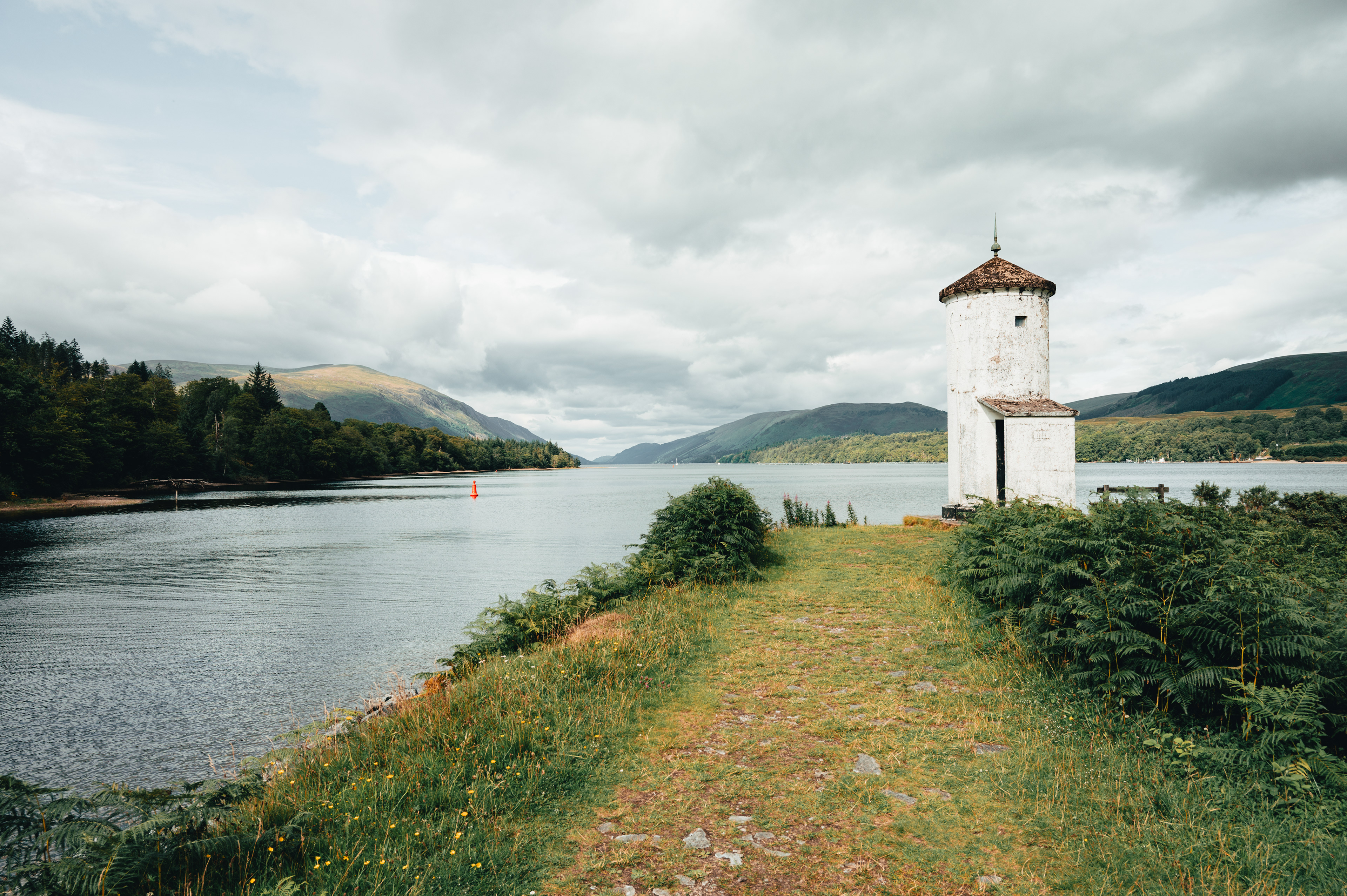
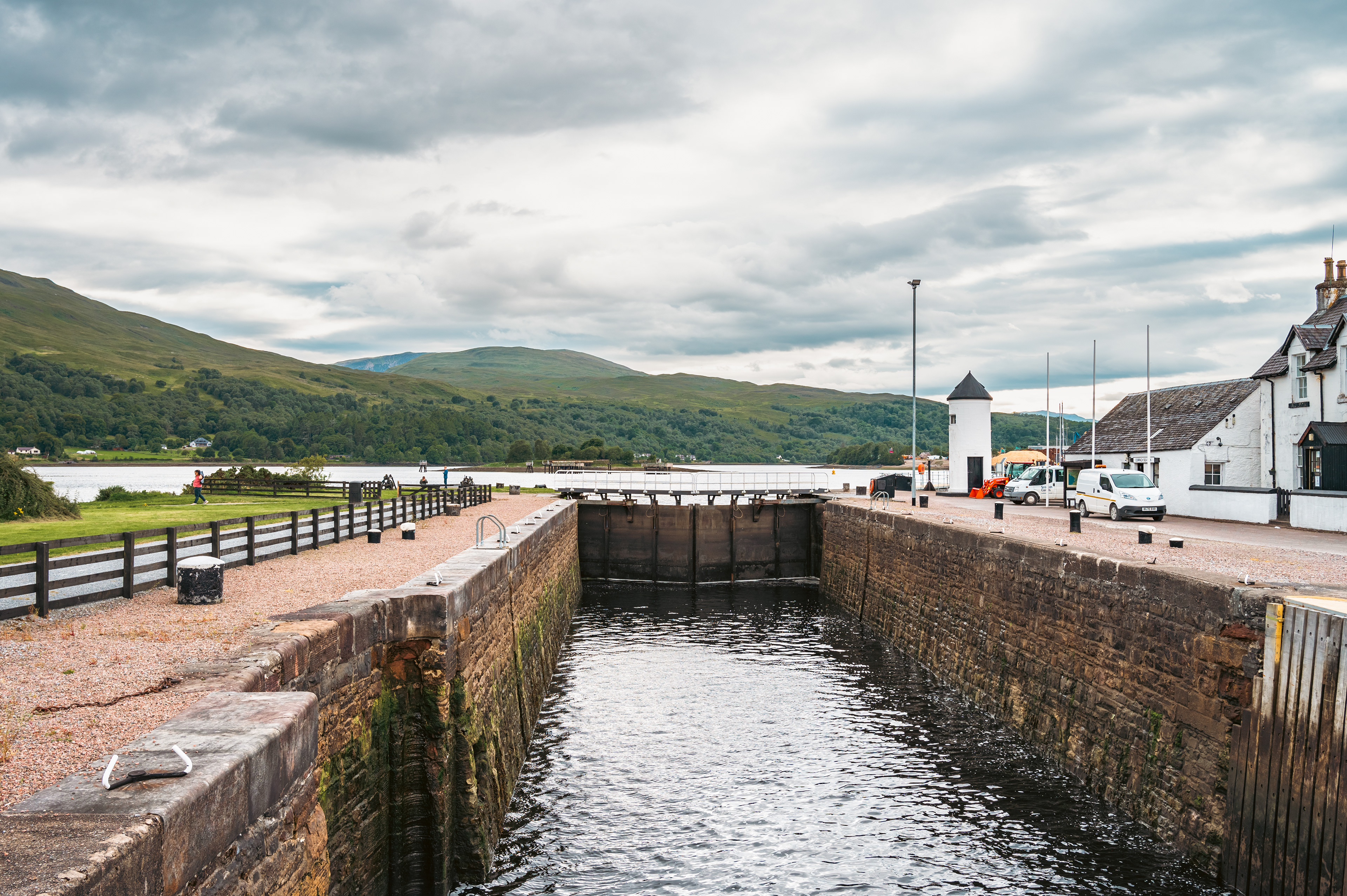
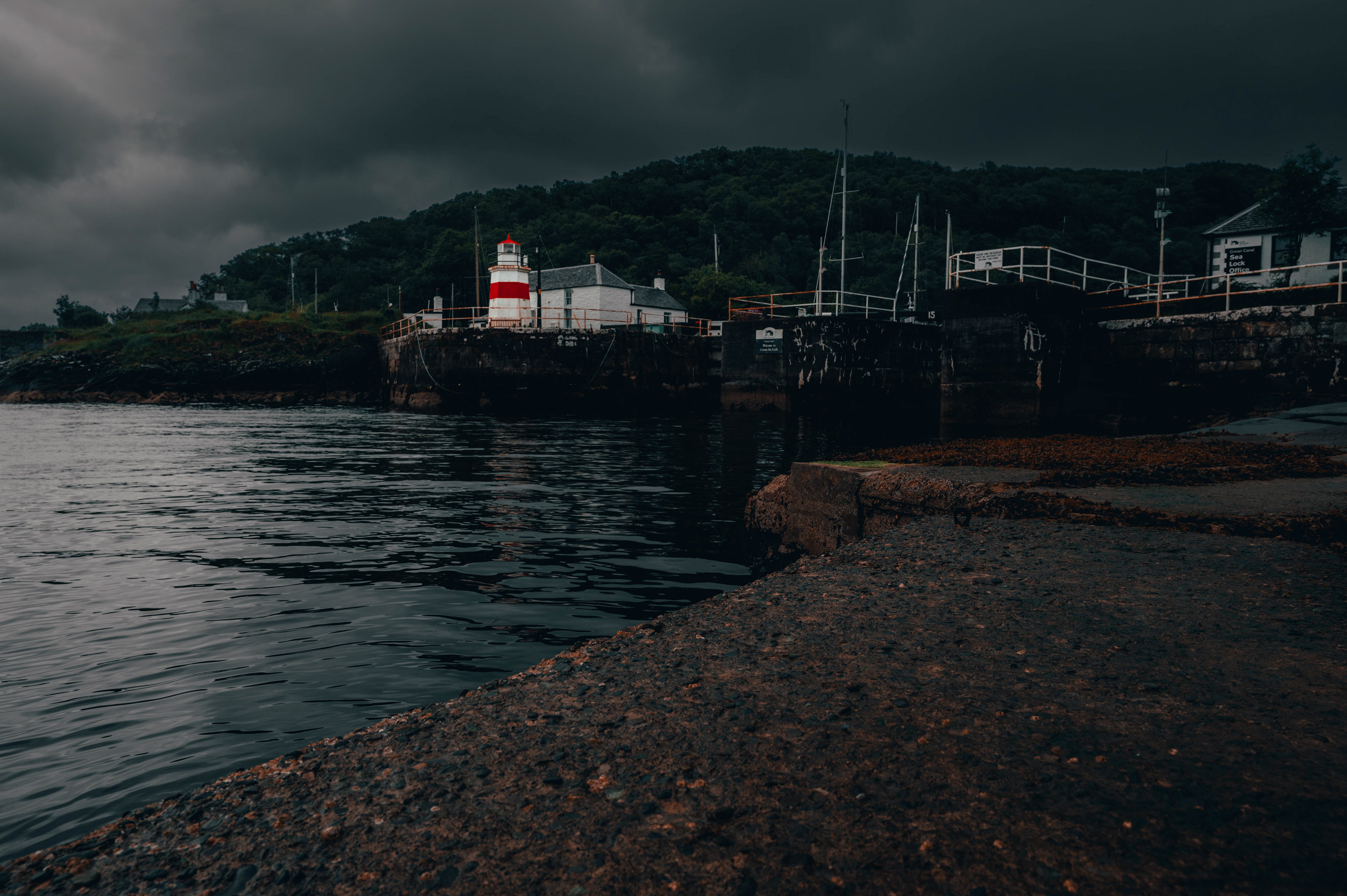
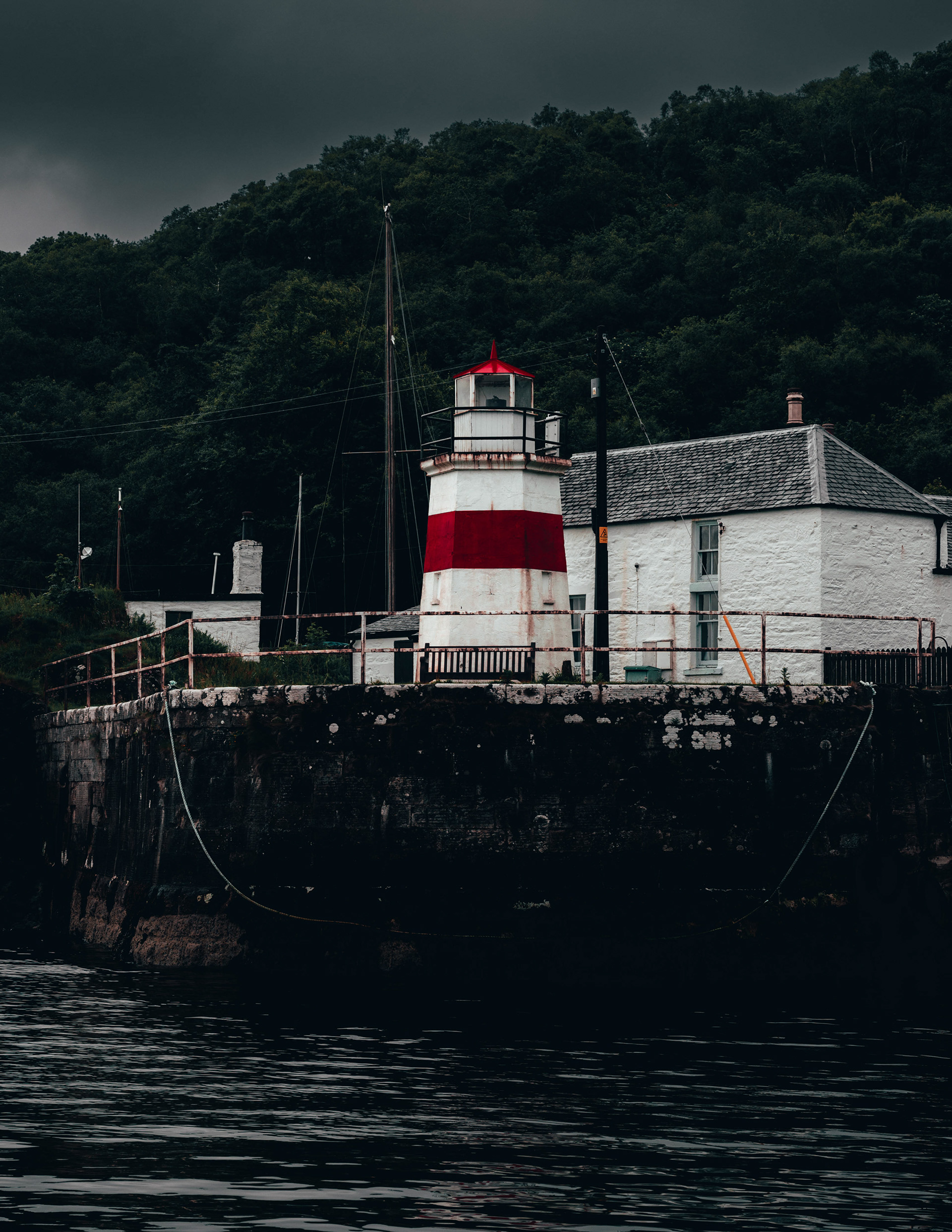
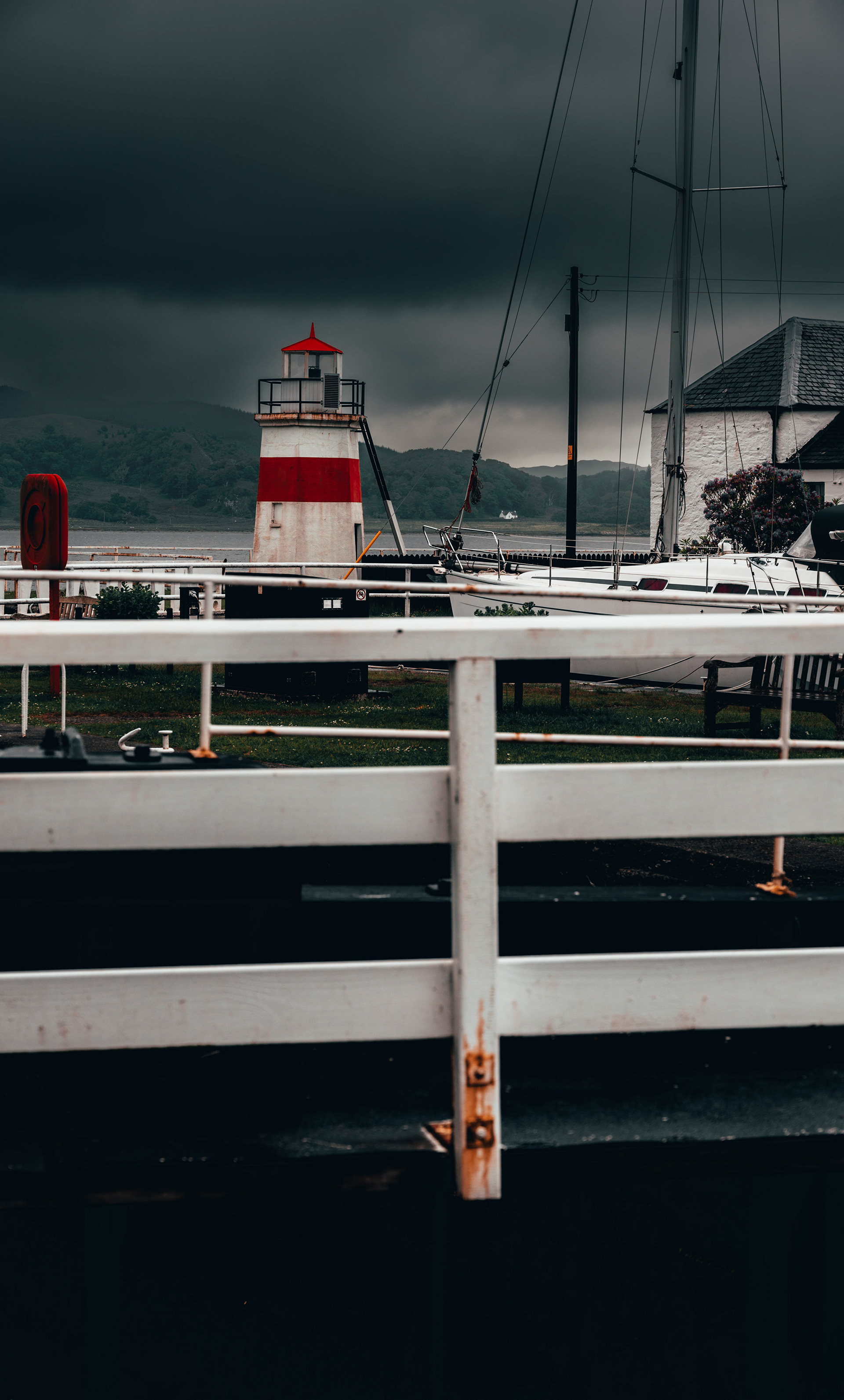
CORRPACH
56º50’34”N 5º7’26”W
Corpach is a small village near the town of Fort William. The name of the Village is derived from the Scottish Gàidhlig, A’ Chorpaich, roughly translating to, Field of Corpses. It is believed to be the place Clan Chiefs were brought here when they died to be ferried to the Isle of Iona for burial. Due to its natural harbour and relative proximity to Loch Lochy compared to Fort William it was chosen as the site for the end of the Caledonian Canal. This small Lighthouse was built at the end of the Canal’s Sea Lock to guide ships into the Canal from the saltwater Loch Linnhe.

Fort Augustus
Fort Augustus
Loch Lochy
Loch Lochy
Corran Sea Lock

Corran Sea Lock
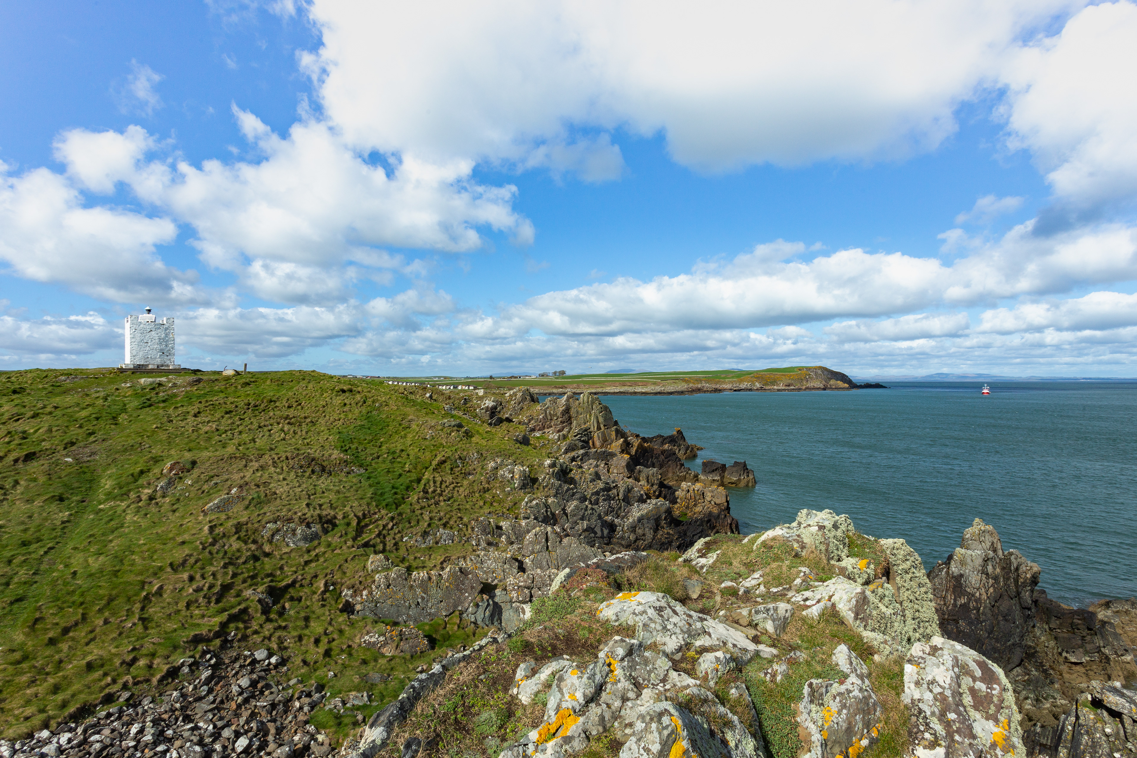
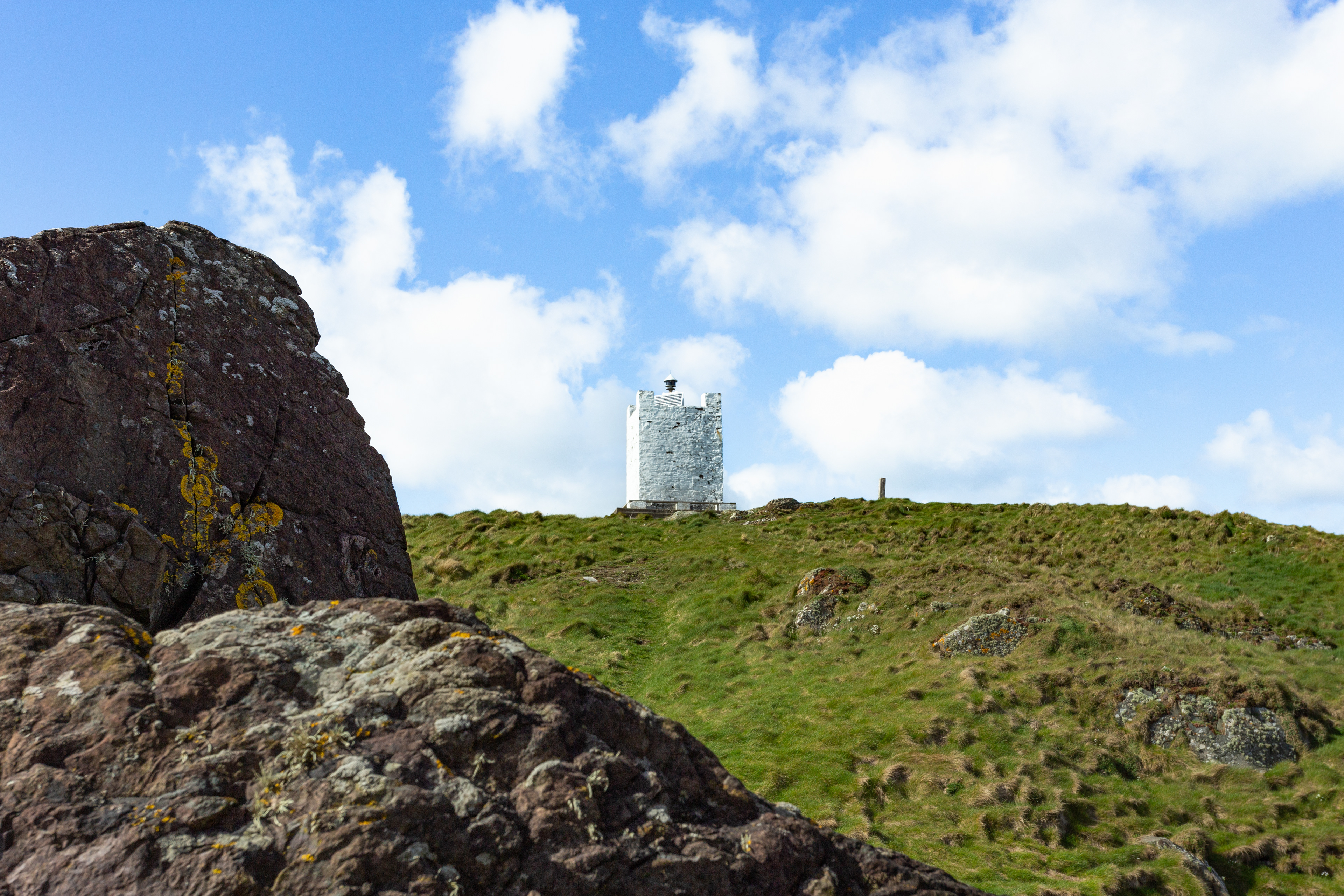
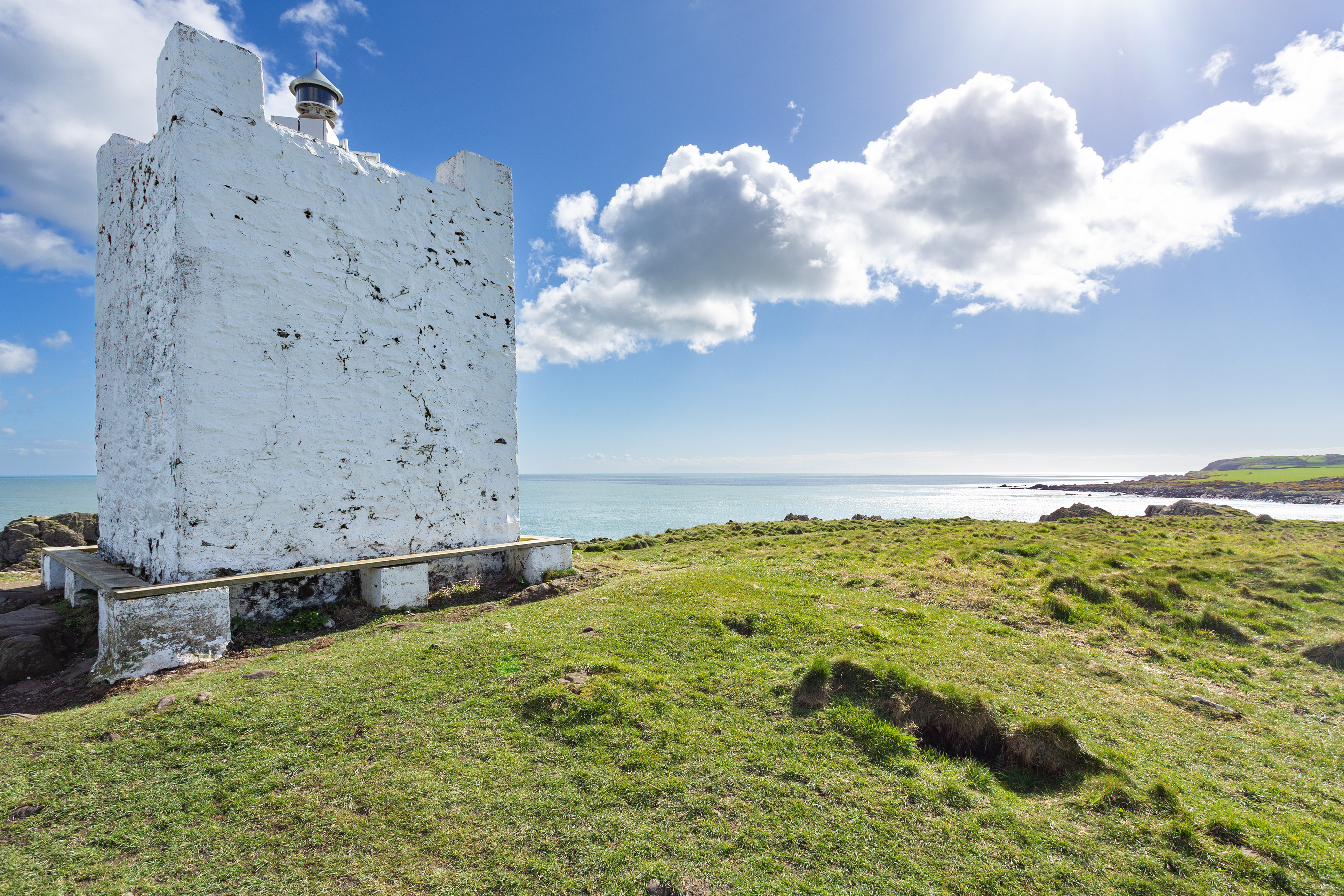
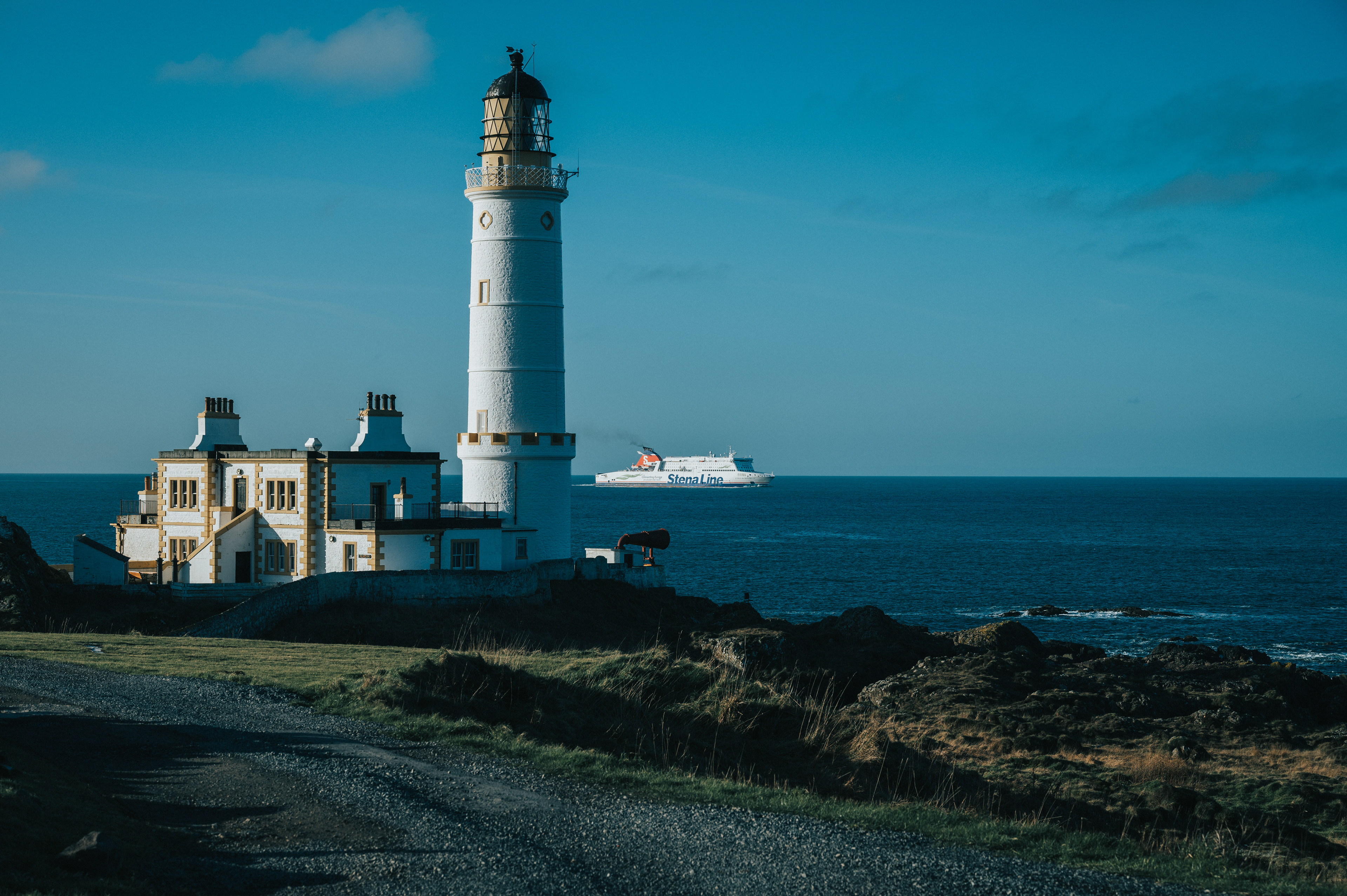
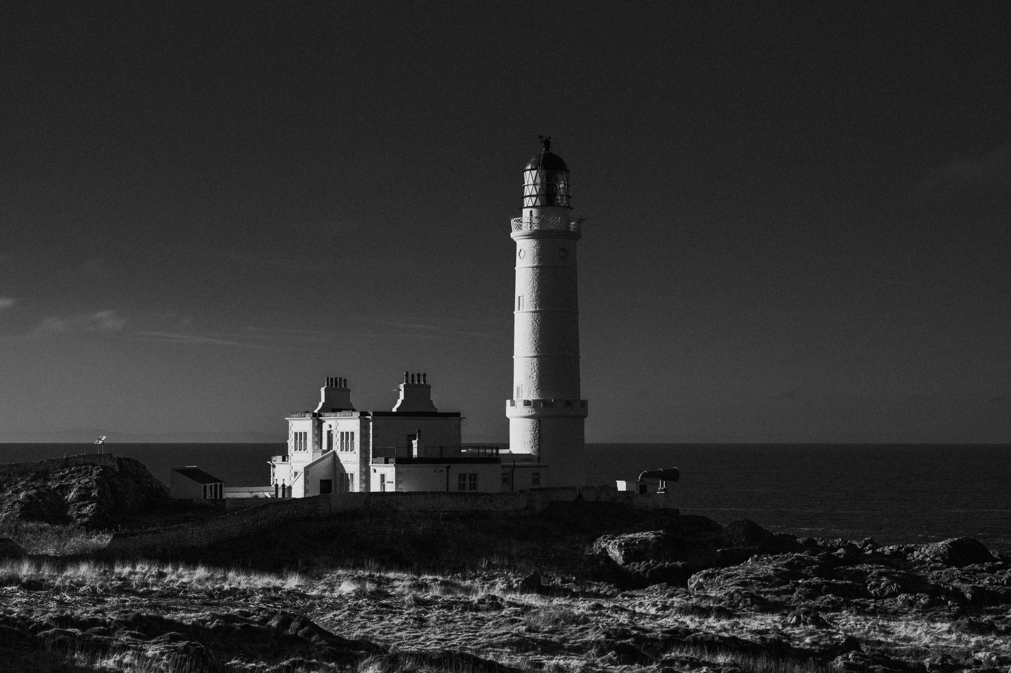
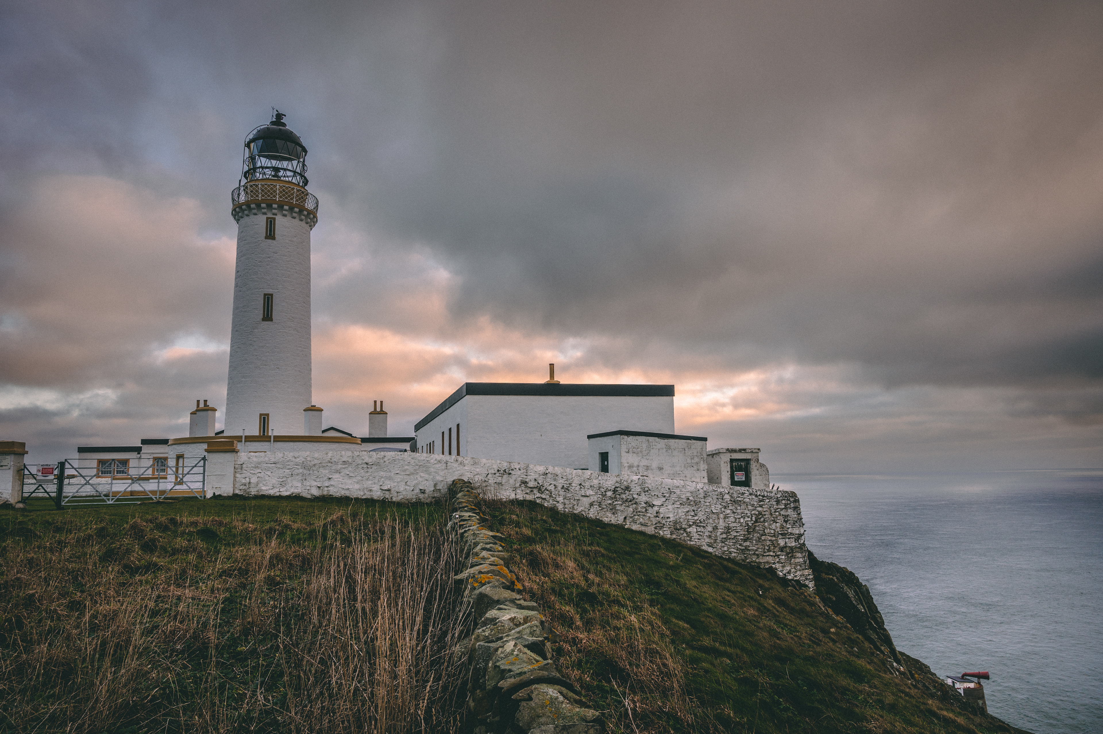
ISLE OF WHITHORN LIGHTHOUSE
54°41'45"N 04°21'31"W
Sitting at the Southern tip of the Whithorn headland this small white tower acts as a navigational aid for ships traveling through the Solway Firth and into the Port at the Isle of Whithorn. The tower is hundreds of years though no one is sure exactly when it was built. The tower has been fitted with a Solar powered lamp turning it into a small modern lighthouse. The tower boasts impressive views across the Solway Firth to the English Fells and the Isle of Man.
Sitting at the Southern tip of the Whithorn headland this small white tower acts as a navigational aid for ships traveling through the Solway Firth and into the Port at the Isle of Whithorn. The tower is hundreds of years though no one is sure exactly when it was built. The tower has been fitted with a Solar powered lamp turning it into a small modern lighthouse. The tower boasts impressive views across the Solway Firth to the English Fells and the Isle of Man.

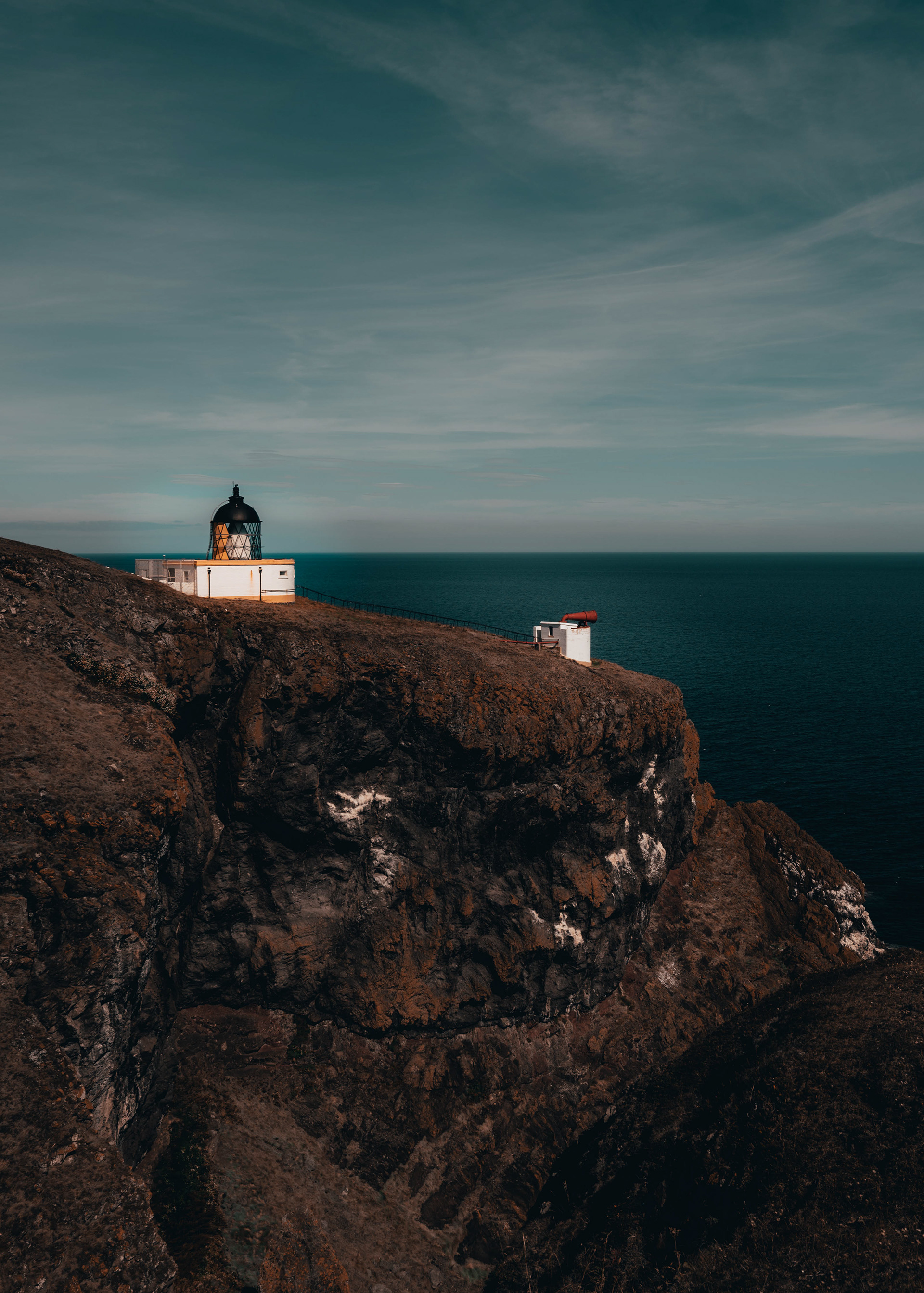
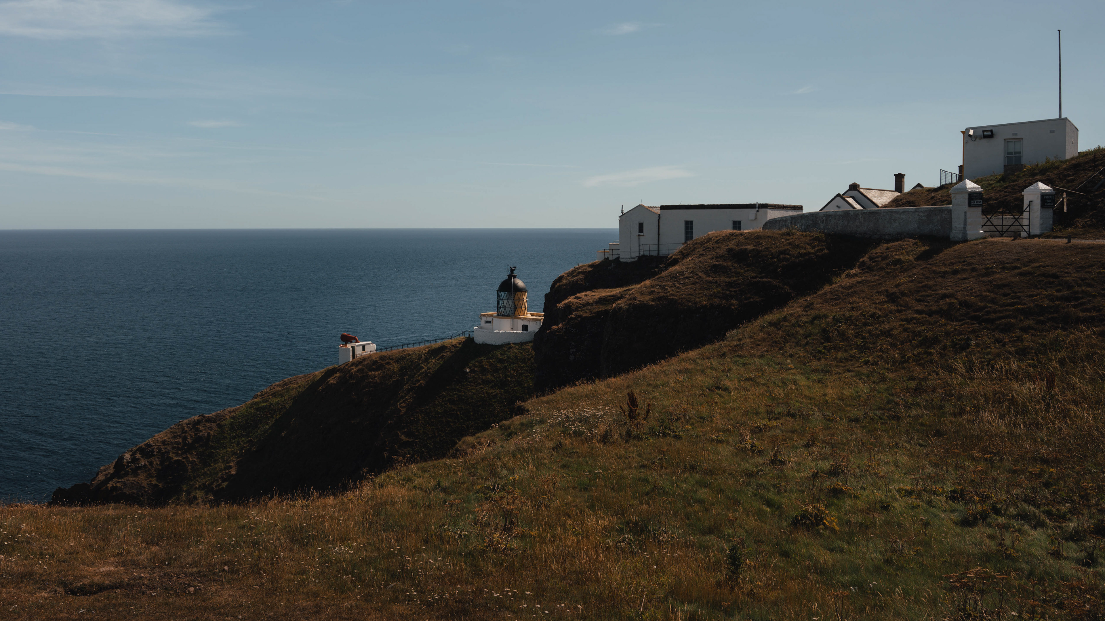
ST. ABB'S HEAD LIGHTHOUSE
55°54′57.9″N 2°08′19.0″W
The Northern Lighthouse Board suggested the building of a lighthouse on St. Abb's head in 1857. Following the sinking of the ship "Martello" on Carr Rock due to "inaccurate steering during heavy weather which prevented lights from being seen." The lighthouse was built and designed by brothers; David and Thomas Stevenson, and first operated in 1862.
Before becoming automated in 1993 the lighthouse had a staff of three full time keepers. Who's responsibilities included maintaining a detailed record of the weather.
The foghorn was first installed in 1876 and was the first audible fog signal in Scotland. It has now be decommissioned.

CRINNAN HARBOUR LIGHTHOUSE - CRINNAN CANAL
56°05'28.6"N 5°33'22.2"W
Marking the sea end of the Crinan Canal stands a hexagonal red and white banded lighthouse. The lighthouse was built in 1851, to guide ships into the canal from the Sound of Jura. It has one of the shortest ranges for a nautical lighthouse at only 4 miles.
The canal was constructed between 1794 and 1804, to link Loch Fyne, and the industrial central belt, to the Sound of Jura, and the Highlands and Islands beyond, while avoiding the long dangerous sea route around the Mull of Kintyre. Finished two years behind schedule and vastly over budget, the canal was never truly commercially viable and is now mostly used by pleasure craft and a few smaller fishing boats.
The Lighthouse at Ardrishaig is believed to have been built around 1880, however maps show a lighthouse on the site as early as 1867. The current lighthouse is a good example of an early ashlar stone signal.
MULL OF KINTYRE LIGHTHOUSE
55°18′38″N 5°48′12″W
The second lighthouse commissioned by the Northern Lighthouse Board The Mull of Kintyre Lighthouse is one of the oldest serving lighthouses in Britain. Sitting high up on the cliffs on the western edge of the Mull of Kintyre the Lighthouse has views across the North Channel to Ireland, Rathlin Island, as well as the Inner Hebridean islands of Jura, and Islay to the North.
The light was first ignited on November 1st 1788. It had taken two years to build the light as the site was inaccessible from the sea and the overland route was over the rough hills of the Kintyre Peninsula. Building materials had to be landed by boat six miles away and carried in on horseback as there was no road.
The Keeper in 1817 was granted an extra £5 a year to keep a horse to help him collect provisions from the lighthouse's store, located seven miles from the Lighthouse itself.
The lighthouse was rebuilt in 1820's with the work finishing in 1830. A fog horn was later added in 1876, but it failed to protect the the Steamer "Signal" which ran aground of the Mull in 1895 in dense fog. Everyone aboard the ship was rescued, however questions were later raised about the effectiveness of the foghorn due to the long intermission between blasts.
ARDRISAIG LIGHTHOUSE - CRINNAN CANAL
56°0'45"N 5°26'35"W
Ardrishaig Point Lighthouse stands on the tip of the break-water at the eastern end of the Crinan Canal on the Argyll Peninsula.
The canal was constructed between 1794 and 1804, to link Loch Fyne, and the industrial central belt, to the Sound of Jura, and the Highlands and Islands beyond, while avoiding the long dangerous sea route around the Mull of Kintyre. Finished two years behind schedule and vastly over budget, the canal was never truly commercially viable and is now mostly used by pleasure craft and a few smaller fishing boats.
The Lighthouse at Ardrishaig is believed to have been built around 1880, however maps show a lighthouse on the site as early as 1867. The current lighthouse is a good example of an early ashlar stone signal.
TOWARD POINT
55°51’44”N 4°58’47”W
Built by Robert Stevenson in 1812 Toward Point Lighthouse sits at the southern end of the Cowal Peninsula on the edge of Toward village. Toward point marks the south-westerly point of the Highland Boundary Fault as it bisects the Scottish mainland.
The small church like building close to the lighthouse housed the foghorn. It was decommissioned in the 1990’s and is now along with the Keepers cottage a private residence.


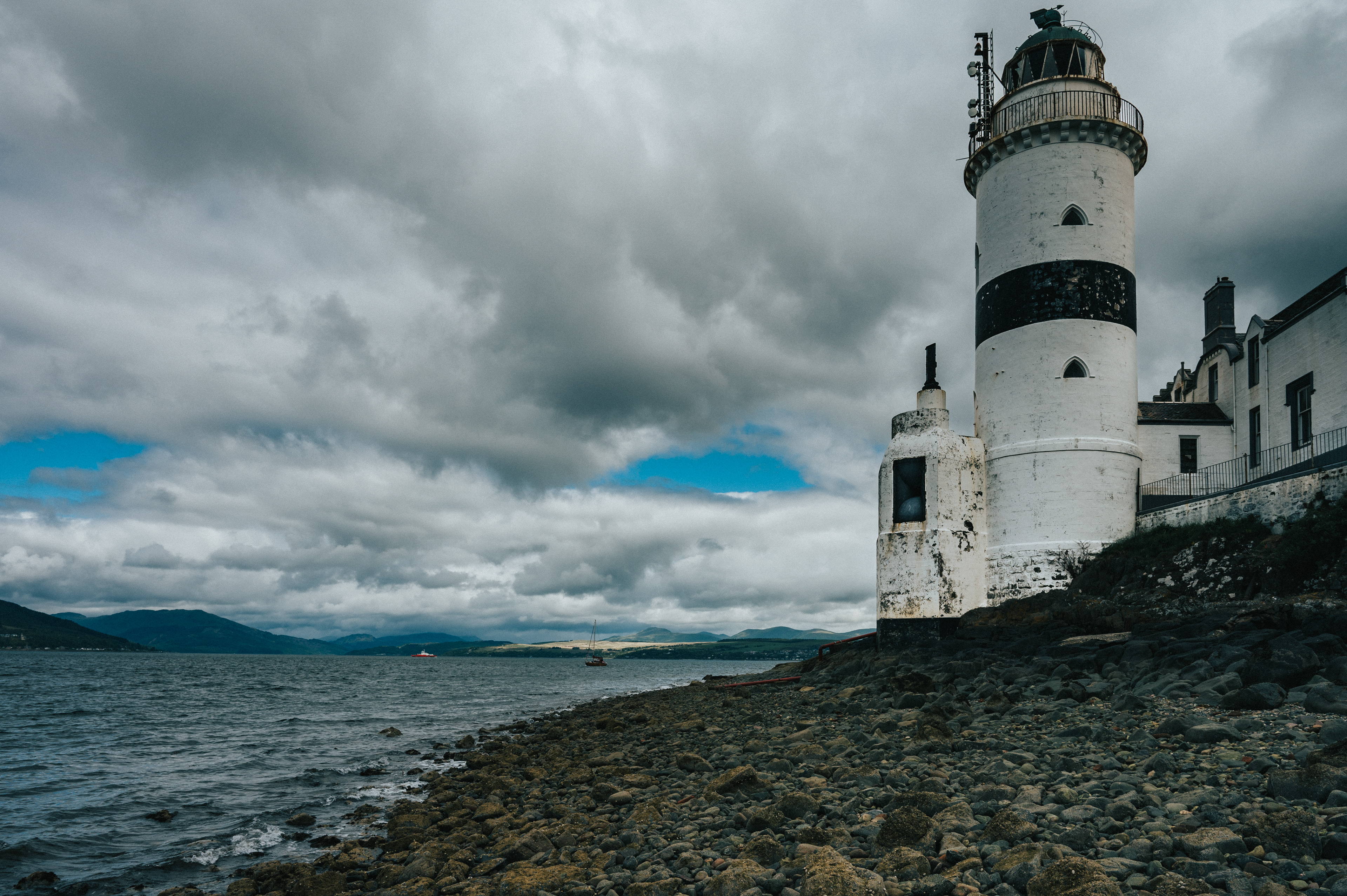
CLOCH POINT LIGHTHOUSE
55º 56‘32“N 4º52‘43“W
Cloch point on the Firth of Clyde has been home to a lighthouse since 1797. Designed by Thomas Smith and his son-in-law Robert Stevenson the light warns ships of the Gantocks. The rectangular-mouthed foghorns were added to the base of the tower in 1897.
The original light's rotation was operated by clockwork, powered by falling weights. This meant that the lighthouse keepers also had to rewind the mechanism every few hours as well maintain the lamp through the night. The light is now attached to the pole on the side of the tower and fully automated.
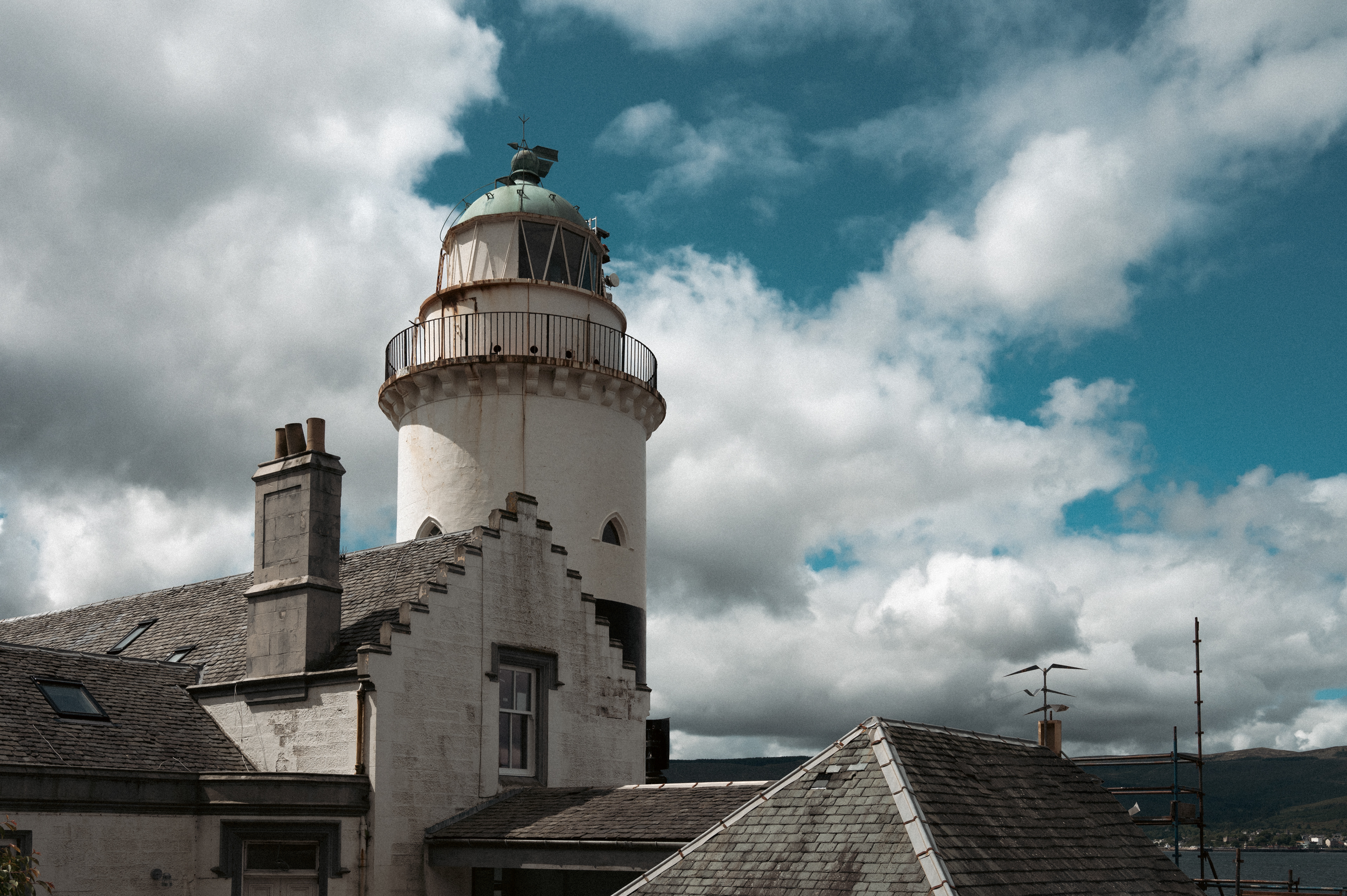
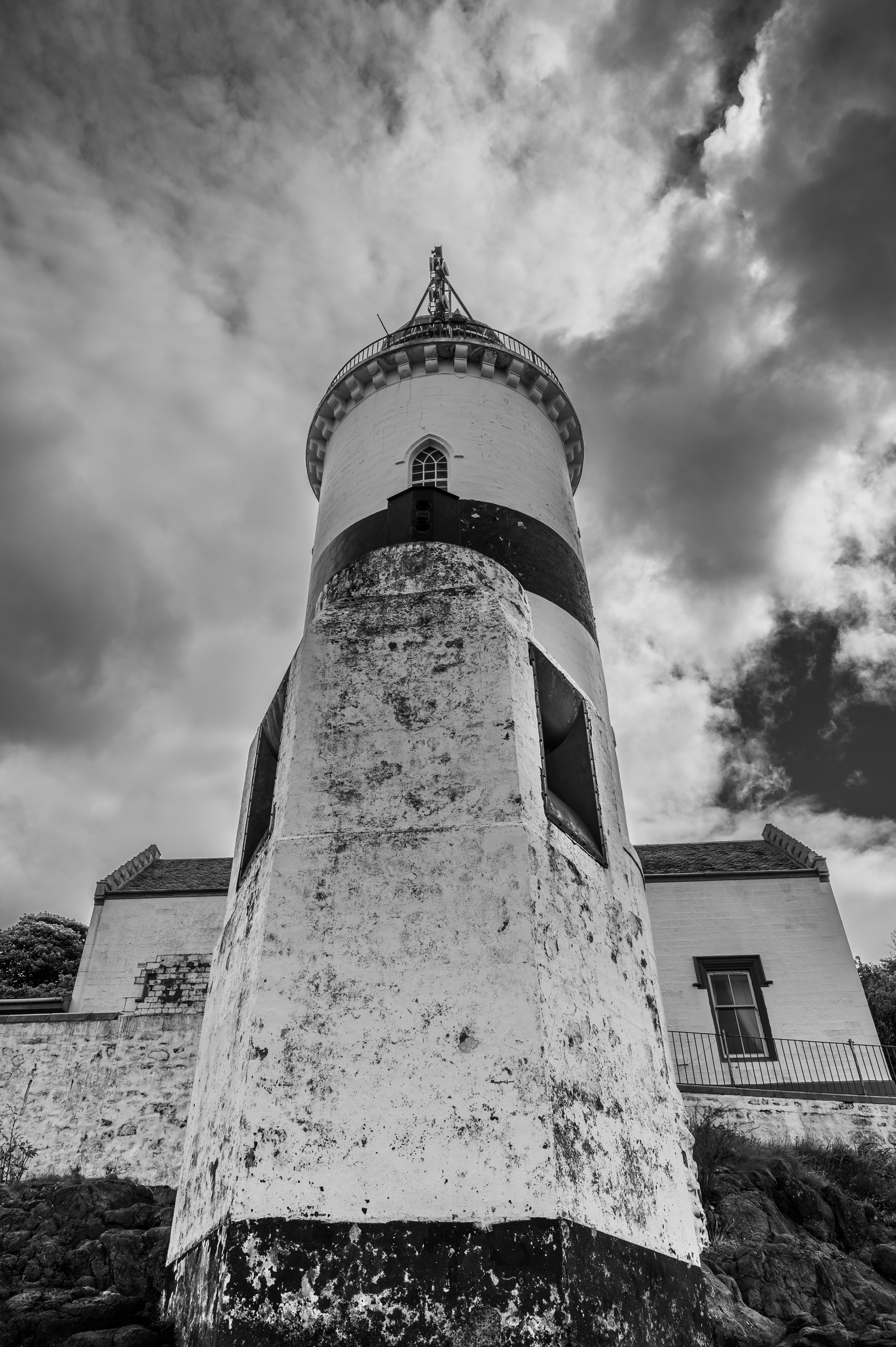
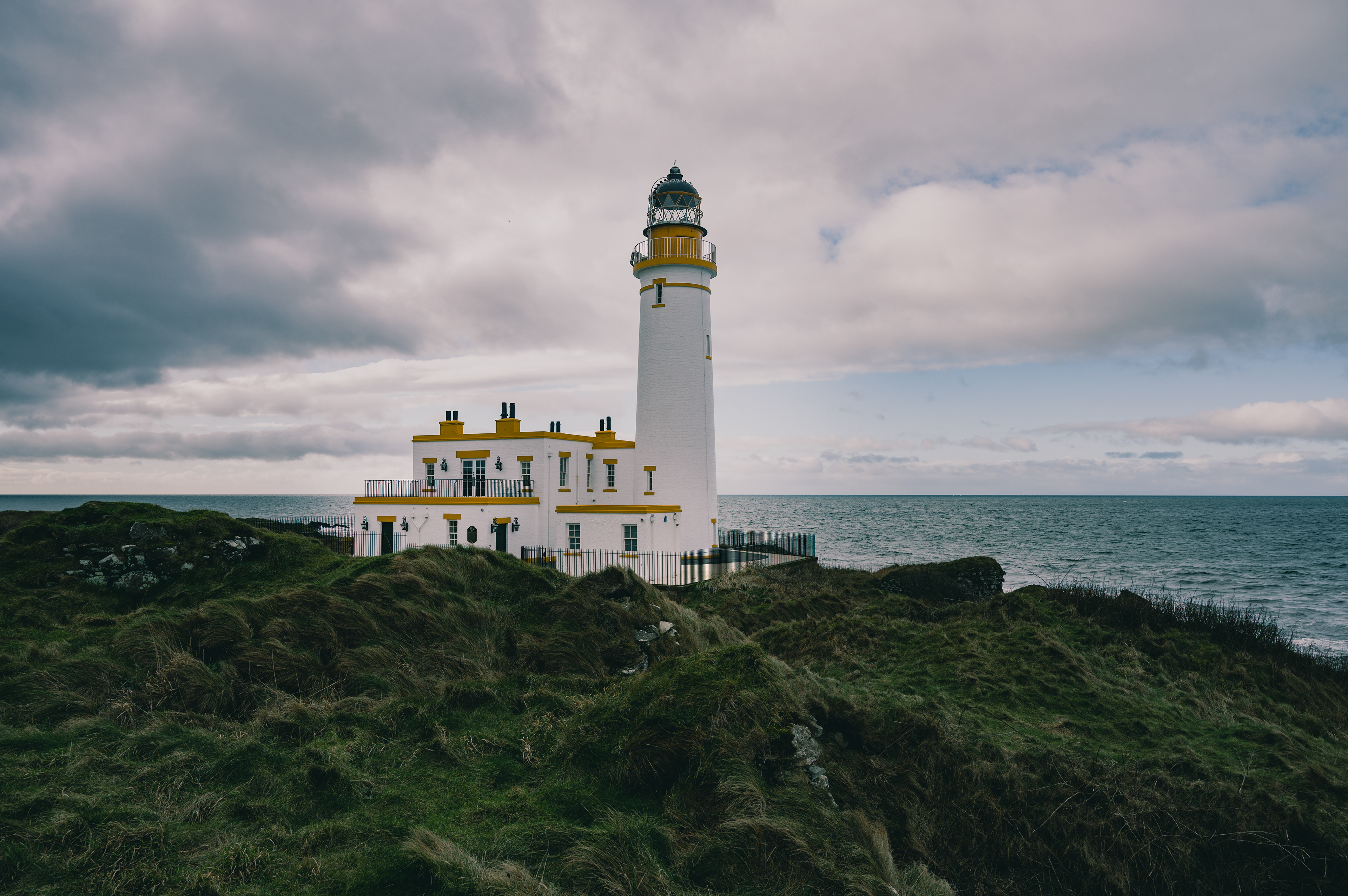
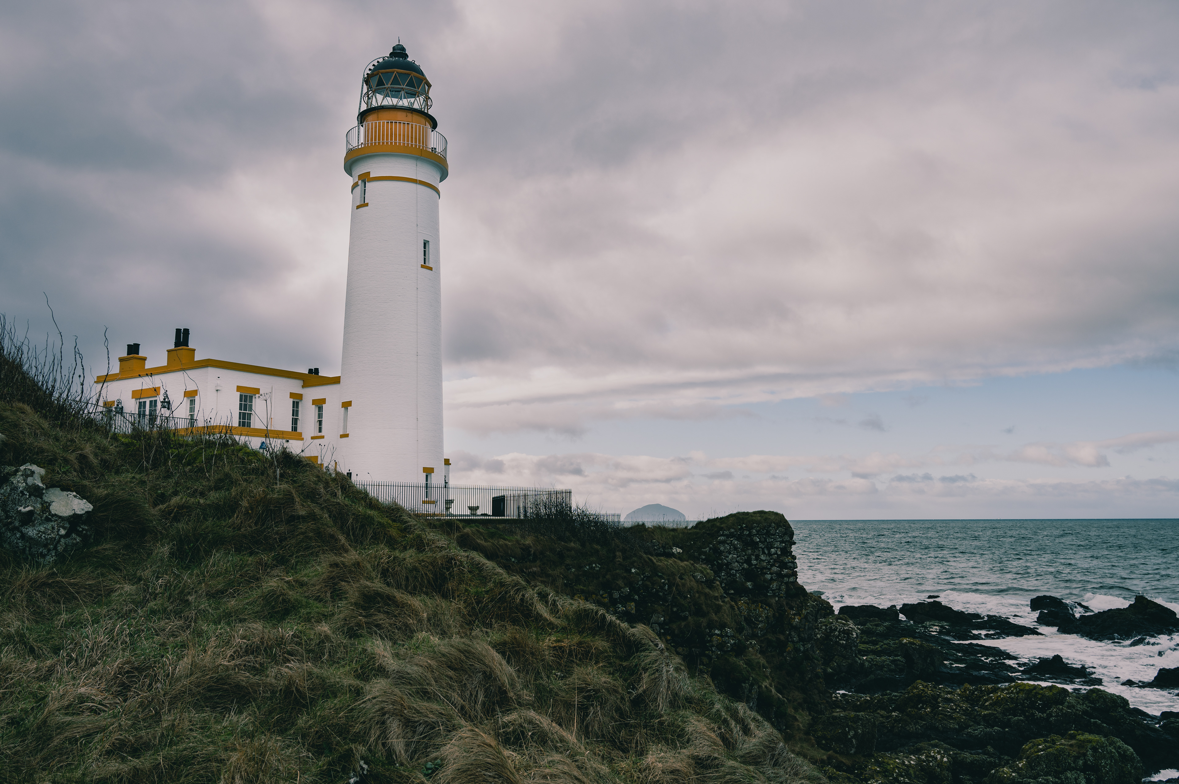
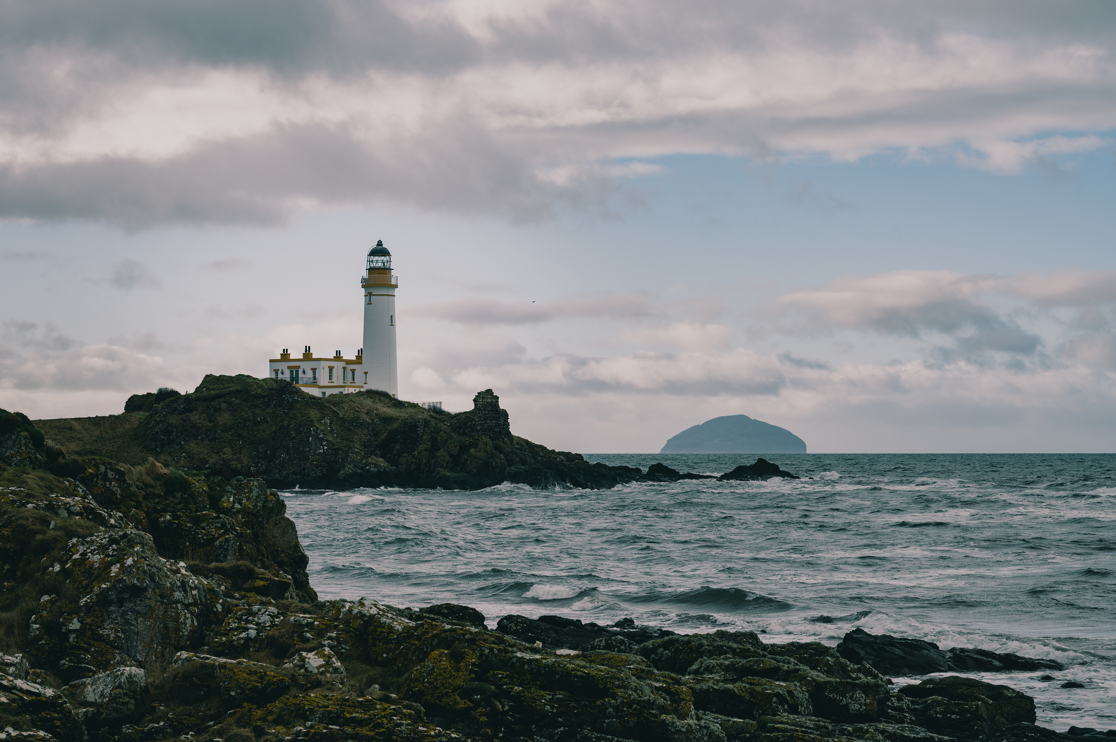
TURNBERRY LIGHTHOUSE
55°19′32.88″N, 4°50′40.7″W
Turnberry lighthouse was built in 1869 on Turnberry point to protect ships from the Bristo Rock which had caused many wrecks. Initial plans were to build the lighthouse on the rock itself but it was deemed unsafe and the nearby point was chosen instead. The point had previously been the site of Turnberry Castle the supposed birthplace of Robert the Bruce. With the lighthouse built on the site of the castles moat. The light was first lit on the 30th of August 1873. The light was manned until 1986 when it became automated. The keepers house has been converted into a restaurant and accommodation as part of the Trump Turnberry Golf estate.
Turnberry lighthouse was built in 1869 on Turnberry point to protect ships from the Bristo Rock which had caused many wrecks. Initial plans were to build the lighthouse on the rock itself but it was deemed unsafe and the nearby point was chosen instead. The point had previously been the site of Turnberry Castle the supposed birthplace of Robert the Bruce. With the lighthouse built on the site of the castles moat. The light was first lit on the 30th of August 1873. The light was manned until 1986 when it became automated. The keepers house has been converted into a restaurant and accommodation as part of the Trump Turnberry Golf estate.
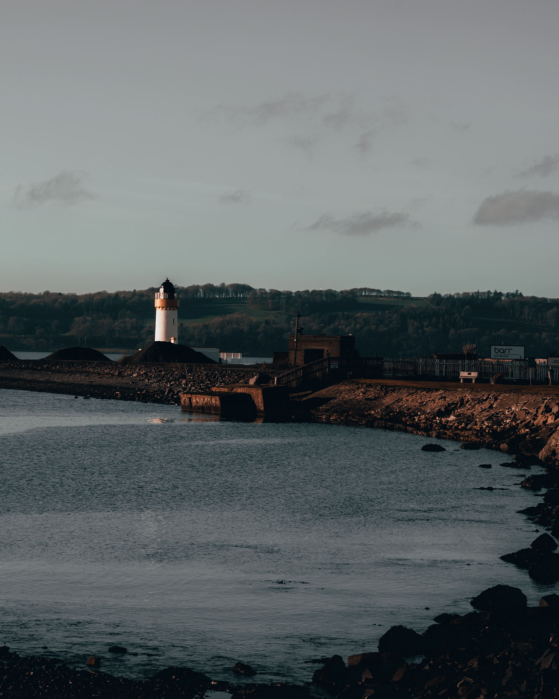
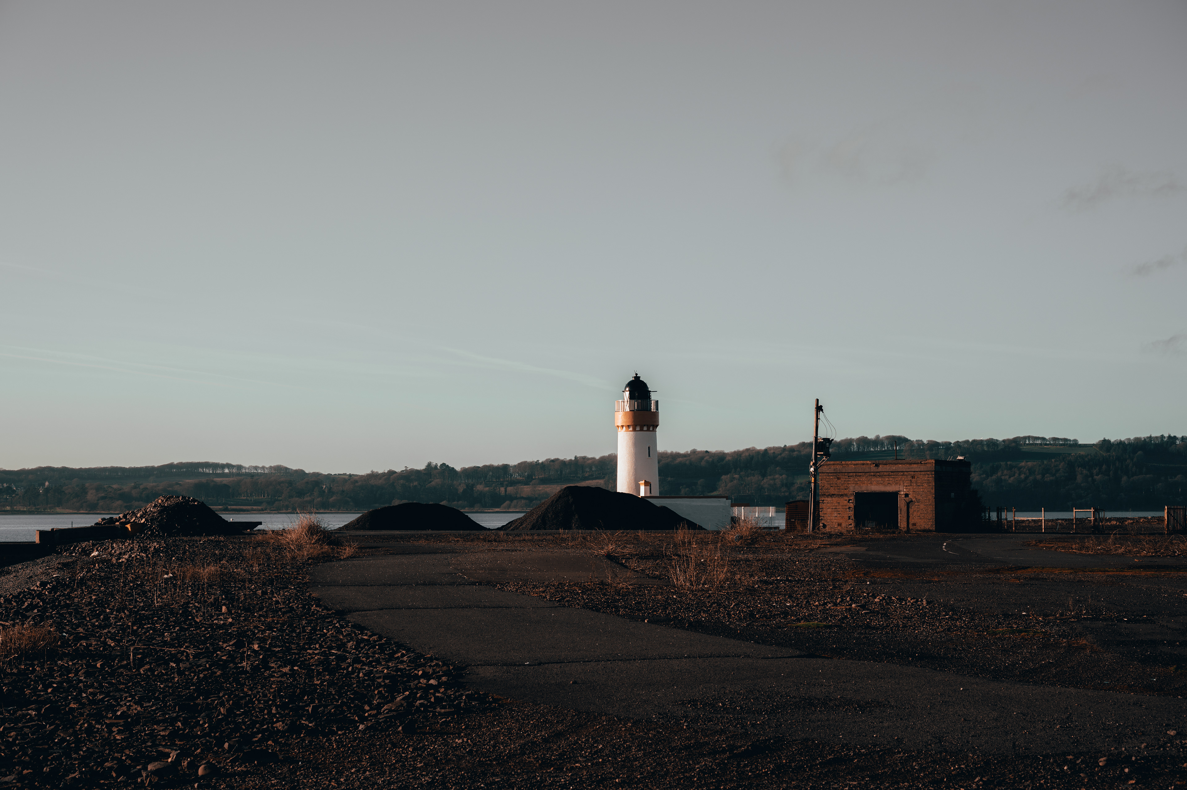
LOCH RYAN LIGHTHOUSE
54°58′28.09″N, 5°1′ 51.1″W
Cairn Point Lighthouse also known as Loch Ryan Lighthouse was built in 1847 ahead of the nearby town of Stranraer becoming the main port between southern Scotland and the north of Ireland in 1849. Before this, the main port had been at Portpatrick on the Rhins to the west, however the increasing tonnage of the ships that were using the route meant that a safer, less exposed, harbour had to be found. Loch Ryan offered the perfect candidate and the lighthouse was built to guide ships past the east bank of the sea loch.
The light was automated and the keepers house demolished in the 1960’s. Today the light is hard to visit as it is situated in an industrial yard with restricted access, despite this it still guides passenger ferries in and out of the port at Cairnryan as they make the crossing between Scotland and Ireland.

CORESWALL LIGHTHOUSE
55°0′25.78″N, 5°9′33.83″W
Coreswall Lighthouse was built in the early 1800’s to watch over the north channel of the Irish Sea, and to guide ships around the northern tip of the Rhins of Galloway.
The first head keeper of the light lost his position shortly after the light became active in 1817. Having fallen asleep on duty, the light stopped rotating for some time. He was demoted to assistant keeper and reassigned to the Bell Rock Lighthouse far out in the North Sea.
The light is now operated automatically and the Keeper’s house is now a hotel.
KILLANTRINGAN LIGHTHOUSE
54°51′42″N 5°8′49″W
The name Killantringan, comes from Cill shaint Ringain or St Ringan’s chapel in English, with Ringan being a medieval variation on Ninian. The lighthouse is located near Portpatrick on the Rhins of Galloway and served as a waypoint for ships crossing the North channel of the Irish Sea. Commissioned in 1897 by the northern lighthouse board and designed by David Alan Stevenson, it first entered service in 1901. A powerful Foghorn was also installed however this was decommissioned in the 1980’s shortly before the lighthouse was automated. The lighthouse was decommissioned in 2005 after it was decided that it no longer served its original purpose. The tower and keepers house are now in private hands.
The name Killantringan, comes from Cill shaint Ringain or St Ringan’s chapel in English, with Ringan being a medieval variation on Ninian. The lighthouse is located near Portpatrick on the Rhins of Galloway and served as a waypoint for ships crossing the North channel of the Irish Sea. Commissioned in 1897 by the northern lighthouse board and designed by David Alan Stevenson, it first entered service in 1901. A powerful Foghorn was also installed however this was decommissioned in the 1980’s shortly before the lighthouse was automated. The lighthouse was decommissioned in 2005 after it was decided that it no longer served its original purpose. The tower and keepers house are now in private hands.

CRAMMAG HEAD LIGHTHOUSE
54°39′53″N 4°57′54″W
Crammag Head, near the Mull of Galloway, looks out over the Irish Sea from the cliffs on the west coast of the Rhins of Galloway. There has been a lighthouse at Crammag Head since 1903. A new tower however was installed in 2009 although the base of the older tower is still visible near by. There is also a short flight of stairs heading down the cliff to an old platform for bringing in supplies by sea. The platform must of once featured a crane of some kind as it sits far above the level of the sea.
Crammag Head, near the Mull of Galloway, looks out over the Irish Sea from the cliffs on the west coast of the Rhins of Galloway. There has been a lighthouse at Crammag Head since 1903. A new tower however was installed in 2009 although the base of the older tower is still visible near by. There is also a short flight of stairs heading down the cliff to an old platform for bringing in supplies by sea. The platform must of once featured a crane of some kind as it sits far above the level of the sea.
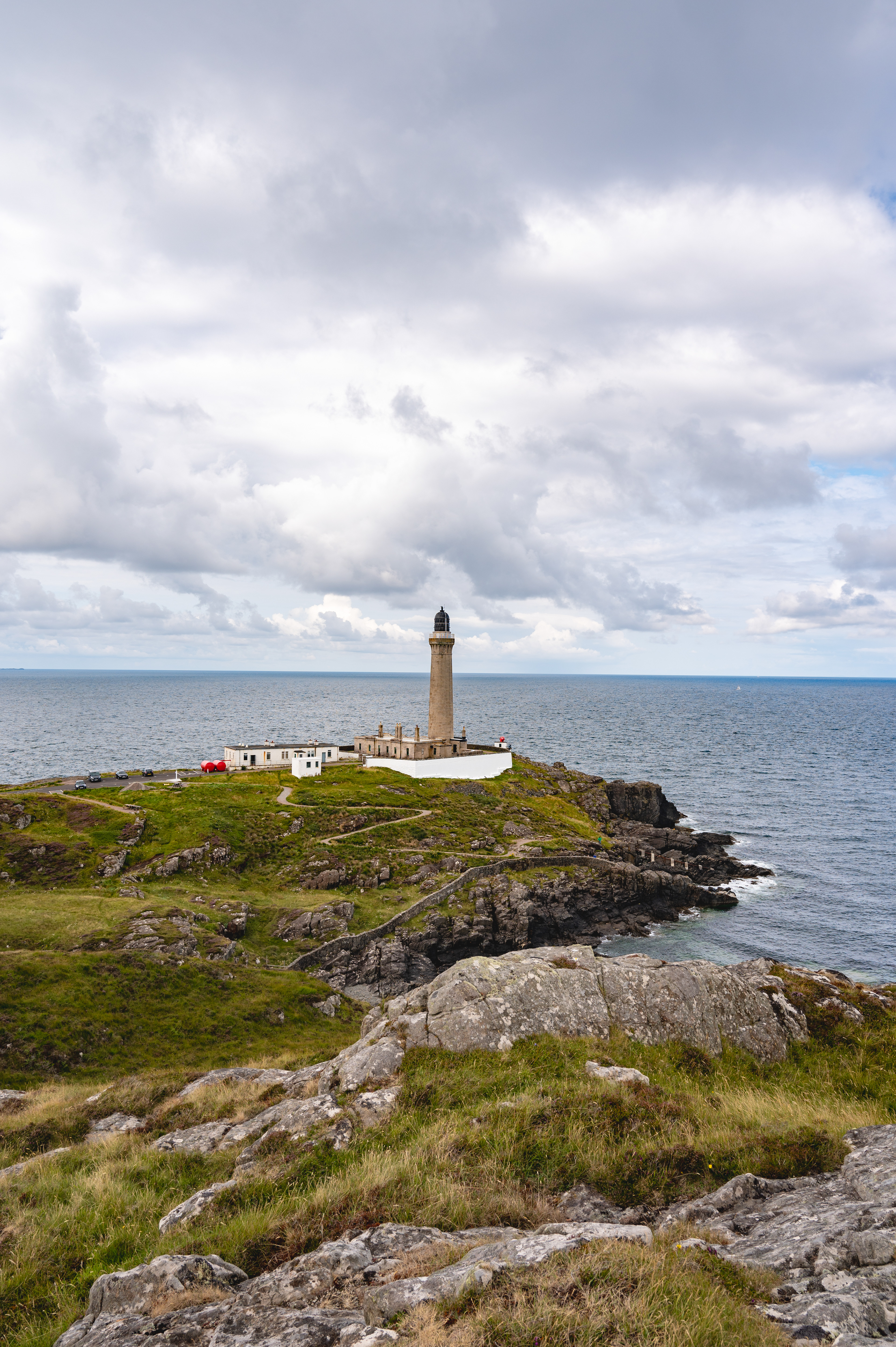
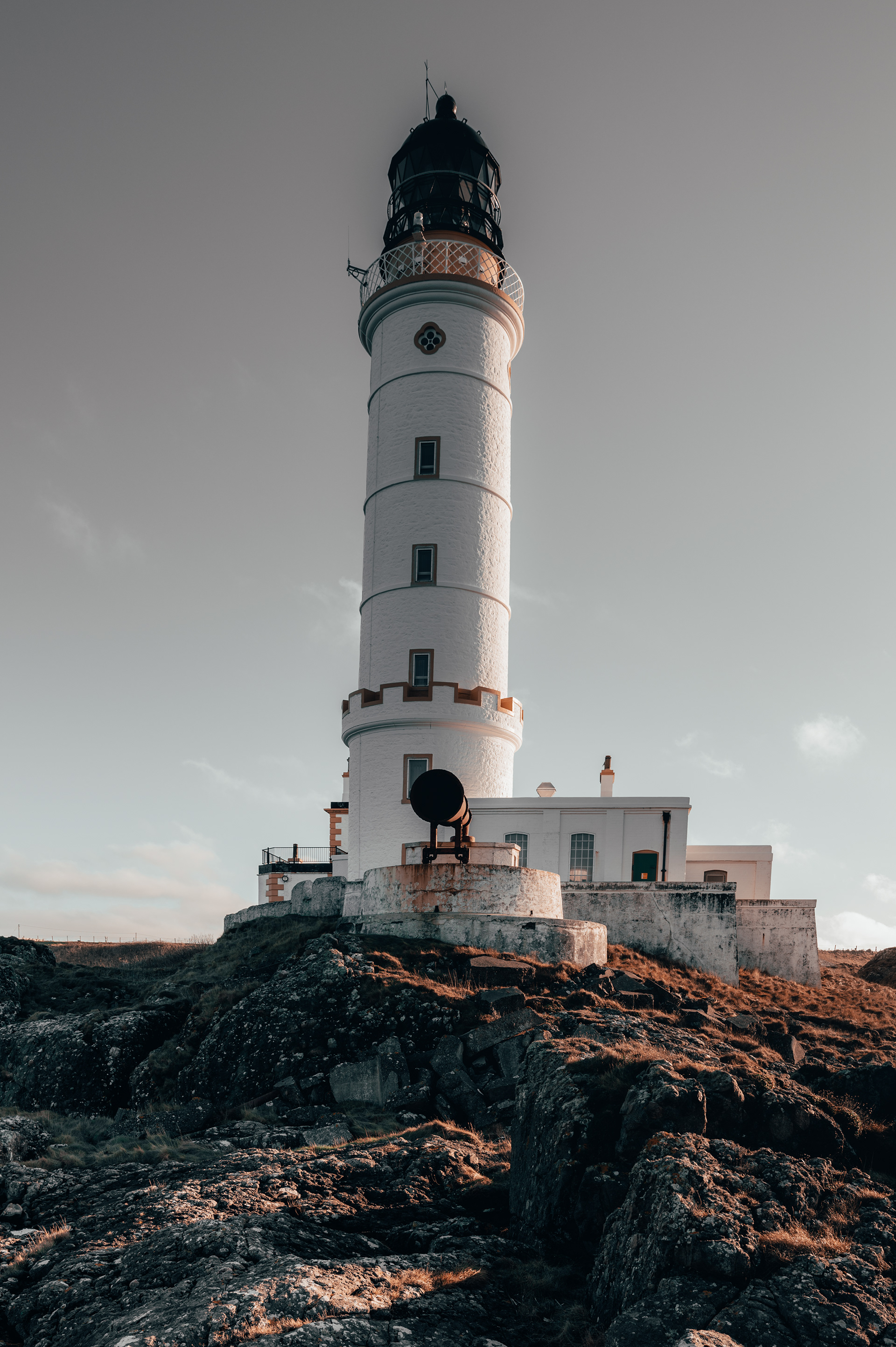
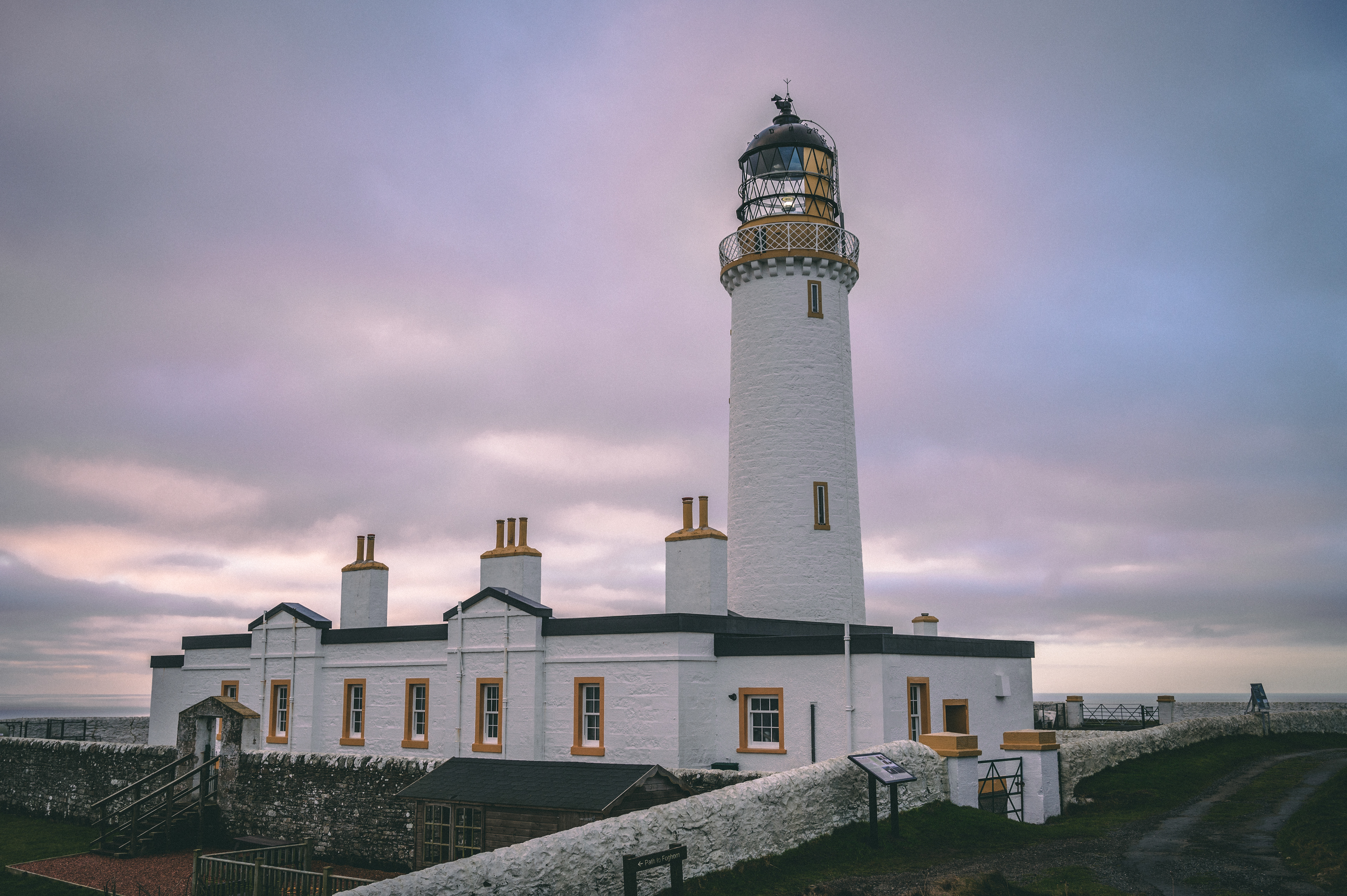
MULL OF GALLOWAY LIGHTHOUSE
54°38′6″N 4°51′26″W
Built in 1820 by famous lighthouse engineer Robert Stevenson the Mull of Galloway Lighthouse stands above the cliffs at the most southern point in Scotland with views to Ireland and the Isle of Man. The tower is 26 meters high, giving the light a range of 28 nautical miles from its cliff top position. In 1944 the lighthouse was the site of aeroplane crash when Cladius Echallier, a French member of the British Air Transport Auxiliary, crashed into the lighthouse whilst attempting preforming a low landfall from the Irish Sea. On the cliffs below the lighthouse there is a foghorn which has been refurbished in recent years after decades of sitting dormant. The land and buildings at the lighthouse now belong to the local community with the exception of the tower which belongs to the Northern Lighthouse board.
Built in 1820 by famous lighthouse engineer Robert Stevenson the Mull of Galloway Lighthouse stands above the cliffs at the most southern point in Scotland with views to Ireland and the Isle of Man. The tower is 26 meters high, giving the light a range of 28 nautical miles from its cliff top position. In 1944 the lighthouse was the site of aeroplane crash when Cladius Echallier, a French member of the British Air Transport Auxiliary, crashed into the lighthouse whilst attempting preforming a low landfall from the Irish Sea. On the cliffs below the lighthouse there is a foghorn which has been refurbished in recent years after decades of sitting dormant. The land and buildings at the lighthouse now belong to the local community with the exception of the tower which belongs to the Northern Lighthouse board.

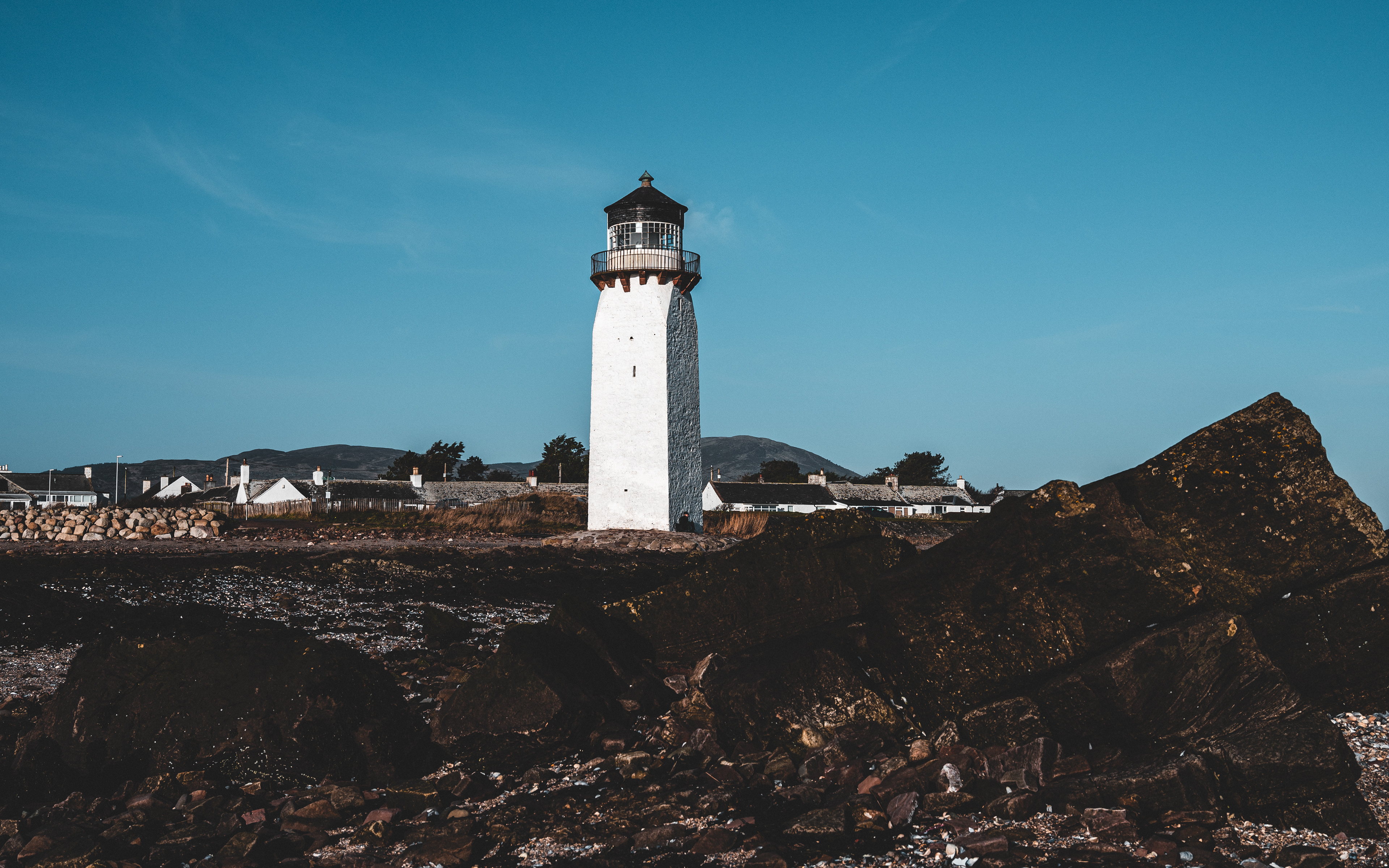
SOUTHERNESS LIGHTHOUSE
54°52′20″N 3°35′36″W
Built near Dumfries on the Solway coast in 1749 Southerness Lighthouse is the second oldest surviving lighthouse structure in Scotland. It was built to help guide ships into the port in Dumfries with major trading links existing between Liverpool and Ireland. The Light also guided local boats and ships as the local road network was so sparse that much of the local trade between towns and villages was completed by river and sea. Over the years the tower was redesigned or rebuilt at least three times, including work led by Robert Stevens in 1805. The light was last used in 1936.
Built near Dumfries on the Solway coast in 1749 Southerness Lighthouse is the second oldest surviving lighthouse structure in Scotland. It was built to help guide ships into the port in Dumfries with major trading links existing between Liverpool and Ireland. The Light also guided local boats and ships as the local road network was so sparse that much of the local trade between towns and villages was completed by river and sea. Over the years the tower was redesigned or rebuilt at least three times, including work led by Robert Stevens in 1805. The light was last used in 1936.